What Exactly is GPR and Why Do I Need It?

What Exactly is GPR and Why Do I Need It?

Digging up the ground is so much work and takes so much time. Locating where utilities and structures are underground before digging would make the excavation so much easier.

This is why utility locators, construction companies, and archeologists use Ground Penetrating Radar technology.

Ground penetrating radar technology, commonly known as GPR, is a method of capturing images underneath the ground through the use of electromagnetic energy. As such, GPR technology makes subsurface mapping and locating objects so much easier.

These services have many advantages, from reducing time and effort in locating any object underground to minimizing possible accidents from damaged utility lines.

How Does GPR Work?

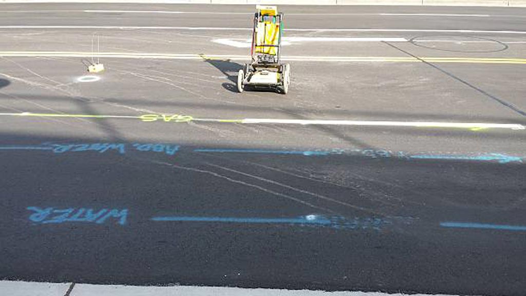
A ground penetrating radar uses a transmitter to send signals in the form of radio waves in the 1 to 1000 MHz frequency range into the soil, concrete, or another material.

When these signals hit any object in the soil or concrete, they bounce back, reflecting, refracting, and scattering. It uses an antenna to receive and record these reflected signals, and from there the device calculates the depth and position of an object under the ground.

Aside from measuring depth and location, a ground penetrating radar GPR can also detect material property, size, and shape. This makes generating 2D or even 3D images of objects possible.

Advantages of Ground Penetrating Radar Technologies

As mentioned earlier on in the article, such imaging technologies can detect a wide range of materials buried beneath the surface without damaging the surface.

Compared to calling 811 or using old utility maps, this type of radar can help determine where utility lines are right when you need to know it. It therefore helps eliminate the need for additional allowances in distance due to human error or movement in utility positions due to temperature changes.

Unlike other methods of subsurface mapping, GPR can characterize subsurface properties and identify what kinds of compounds are underground in any given infrastructure. It does so by gathering a wide set of data which makes subsurface geo-referencing possible.

What’s more, GPR’s real-time data features means it’s useful for detecting forgotten or undiscovered items, underground facilities, and other types of surveys.

Utility Mapping Applications

This imaging method can find variances in the return signals caused by different electric charges depending on the substance detected. These services are especially useful for mapping structures since excavators can accurately plan around whatever is underneath the ground.

Such data is then used by excavators to avoid digging accidents, or even by archaeologists to dig up promising artifacts.

GPR, detects metal and nonmetal materials such as plastic, concrete, wood, stone, etc. This makes it useful for detecting electric wires and cables, gas and water pipes, as well as tree roots, stone slabs, and man-made underground fixtures or architecture.

How to Make GPR Data as Accurate as Possible

While there are tons of advantages to using a ground penetrating radar, such services work best under certain environmental factors. To get the most accurate, real-time data from ground penetrating radar services, make sure that these factors are in place.

Soil Properties

One of the conditions needed for GPR to work well is for the surface to be relatively flat; this is necessary to ensure optimum penetration of electromagnetic energy which also results in the most accurate subsurface detection. This means GPR works really well on concrete as opposed to uneven terrain.

Because GPR relies on materials reflecting or refracting signal, anything different from the scanned material can obstruct the reading of the device and limit its extensive scanning capacity.

Depth

Another factor to consider when using GPR is the depth of the object or utility you’re trying to locate. Soil is naturally resistant to electricity; this makes scanning objects more and more difficult the deeper it goes into the ground. Depending on the capacity of the device, one may or may not penetrate as deep as 30 meters or 100 feet deep into the ground.

Water Content

The presence of water in the soil or any material found by GPR will also affect how well electromagnetic energy penetrates it because of dielectric permittivity. Dielectric permittivity refers to how conductive the soil or any surface is, which impacts how a GPR device receives the reflected or refracted signal it sends out.

What Is the Difference Between GPR and Seismic Reflection?

Though GPR and Seismic reflection both try to understand subsurface structures or characteristics, GPR uses electromagnetic energy in the form of radio waves whereas seismic reflection uses acoustic energy in the form of seismic waves.

GPR sends out high-frequency radio waves to detect changes in the electrical properties of a surface. Such changes exist when there’s an object made of a different substance than soil or concrete, as scanning can usually detect the varying electrical properties.

Meanwhile, seismic reflections rely on seismic waves hitting things or surfaces and reflecting back. A seismic device then records the surface’s elastic properties and density, both of which impact the signal reflected back.

Because they scan subsurface characteristics differently, GPR is best used for detecting things like artifacts and utilities whereas seismic reflection is best used to map flat surfaces.

Hiring a Professional Team

Ground penetrating radar equipment can cost anywhere from $15,000 to $50,000. This is a hefty investment for a homeowner in need of some utility mapping for a digging project. While you can rent a device for around $1,000 to $2,000 a day, that’s still impractical especially when you are not used to using it and interpreting the data it gives.

The accuracy of any GPR process relies heavily on who uses it. Using GPR incorrectly can lead to a false interpretation which undermines the purpose of utility mapping to begin with.

If your infrastructure project needs scanning and locating expertise, contact Util-Locate! Our team is made up of trained professionals who use GPR to expose all underground utilities for the most efficient utility locating and mapping services. For any questions about utility surveys or penetration projects, call us today!

12 Best Safety Practices During Utility Location

12 Best Safety Practices During Utility Location

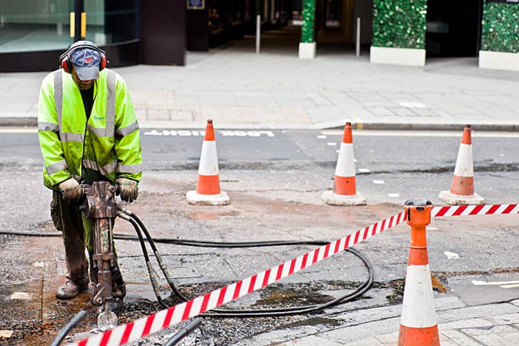
Working outdoors is prone to many safety hazards. This holds especially true for projects like excavation work or utility locating. Digging up the ground where underground lines, cables, and pipes present many dangers, both natural and man-made.

As such, it’s absolutely important to observe the utmost precaution to ensure everyone’s safety and the success of any project. Effective planning involves thorough utility locating, utility infrastructure investigations, damage prevention as well as mitigation measures for issues identified during preliminary surveillance.

Plan Effectively

Every project is unique and will have its own schedule, budget, location, and scope. Depending on these factors, contractors will have to come up with a plan that will please the client while also ensuring the safety and wellbeing of the workers.

But utility locating happens outside where safety hazards abound and circumstances are unpredictable. Therefore, one must prepare contingencies for all possible scenarios that might take place.

Call Before You Dig

An easily avoidable common mistake is accidentally hitting or damaging a utility line. To do so, always call 811 before you dig. This holds true even for utilities projects that may seem simple and straightforward.

811 is the national call number for preventing the unintentional striking of underground utility lines. Pre excavation, call 811 to request help flagging the approximate locations of buried utilities in the area where you plan to excavate.

Create A Utility Map

While you should call 811 before excavation, it’s also good practice to devise a utility map before starting any utility service project. After all, there may be some private utility cables or unknown underground utility lines that 811 is not aware of or their information may be not updated.

To build a utility map, you can use old utility maps as a reference but never use them to guide your excavation. Utility maps need to be updated and creating one right before a new project is the best way to avoid accidents.

Homeowners near your excavation site usually know where their private utility lines are. One can also look for tanks and meters around a property to locate water pipes and electrical or gas lines.

Prevent Cave-Ins

One of the most common accidents experienced by utility locators when doing excavation work or working with underground utilities is collapsed tunnels or cave-ins.

To prevent this, utilities contractors must test the soil composition, as well as design and build structures that will function as support and provide shielding. Testing the soil ahead of time allows them to assess the likelihood of a cave-in whereas support beams can prevent tunnel collapse and shields can protect workers in the event of a cave-in.

Design Walkways and Barriers

No matter how careful excavators are, human error is still a huge risk. Though dropping an object or slipping and falling at home may not result in life-threatening consequences, doing so in a dig site can.

As such, any utility locator or excavator should first set up smooth and non-slippery walkways for workers to securely move about. They must also erect sturdy barriers around the area to prevent people from falling into pits.

Use the Proper Equipment

Excavation projects are no joke. Even with the most experienced utilities workers, most projects can’t be accomplished without the necessary tools.

If you’re a homeowner digging for a one-time project, investing in expensive equipment can be wasteful. Instead, hiring an experienced utility locator who already has such equipment and is experienced in using them to render services is going to be safer and more cost-effective.

These excavators are trained to use equipment such as a ground penetrating radar to ensure survey markings are all recorded accurately.

Prepare Respirators

Dust and dirt are constantly in the air during excavations, which can in turn be hazardous to people’s health. Depending on the utility request, some teams even dig deep enough into the ground that oxygen levels begin to drop. Such lack of oxygen can cause lightheadedness, fatigue, and even fainting.

Before any light digging, workers must wear proper masks. If the project requires excavators to dig deep, workers need respirators or similar devices to help them breathe properly while working. This prevents them from collapsing or feeling sick; it will also help them avoid developing respiratory diseases due to work.

Bring Ear Plugs or Ear Muffs

During excavations, workers are surrounded by noisy equipment. Though this is part of the job, anyone exposed to high levels of noise for prolonged periods can risk ear damage and hearing loss.

Before starting any project, always conduct a noise assessment. If noise levels reach 85 dBA as an 8-hour TWA or more, workers must wear protective PPE like ear plugs or ear muffs.

Educate Workers

When digging, workers use heavy-duty dangerous equipment. Such devices need proper handling; otherwise, they can cause severe injuries while on the job. This is why educating workers is incredibly important. Moreover, workers must also be educated on how to properly use protective gear to ensure their safeties.

As a homeowner or excavation or construction company, it pays to train workers or work with contractors with proper training.

Supervise At All Times

An excavation project can’t just be done willy-nilly. There must be an experienced worksite supervisor who can govern the workers and make sure they all abide by safety protocols and follow the proper operational procedures.

Any compromises in this regard can easily lead to accidents and disaster so insisting on having someone capable at the helm of a project is a non-negotiable.

Put Signs, Reminders, and Warnings

Anyone is bound to forget a thing or two after they’ve been working for hours and days. This is why putting up a sufficient number of signs around the digging area can make a huge difference in disaster prevention.

Though it’s advised to stay at least 18 inches away from a marked underground utility, it’s highly encouraged to dig as far as you can because the mapping is not always accurate. For example, pipes can move due to changes in ground temperature over time.

To account for this reach, make sure to set up the appropriate reminders or warnings before you dig. Doing so in danger zones can boost alertness and vigilance minimizing the chances of accidents. This is also helpful for bystanders and utility owners who may want to help direct the flow of traffic around the utilities site.

Hire Professional Utility Locators

Whether you’re digging to install new underground utilities or doing some landscaping, you always want to observe the safety measures listed above to help protect yourself and everyone else around your worksite.

Accidentally hitting underground utilities can not only cause inconveniences such as water shortage or power interruption, it can also cause fire, serious injury, and possibly even death to the workers involved.

If you’re a property owner and have no experience with utility locating or digging in a utility site, you may not know what to do if you accidentally hit a gas line or a water pipe. Therefore, it’s highly advisable that you leave the job to utility companies or hire professionals who render utility locating services.

Our team is made up of professionals who have been in the utilities industry for years, and we meet all our requests with the utmost care. You can leave your private utility locating and mapping needs to us, so call Util-Locate, your trusted utility locator partner!