Los Angeles County would rank 19th in the world in terms of economic output if it were a country. It is home to almost 244,000 companies, including the highest concentration of minority- and female-owned businesses.
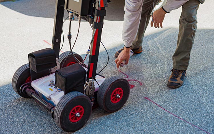
It is the country's primary international business and manufacturing hub. The 37 agencies and $32.5 billion budget of Los Angeles County present a plethora of commercial opportunities for the private sector, both in terms of products and services deals. Having said that, if you're overseeing a project in Los Angeles, Ground Penetrating Radar (GPR) is a service you will need.
GPR for Underground Utility Locating
Util-Locate utilizes state-of-the-art technology and equipment. Util-Locate's over 13 years of experience indicates its ability to provide cost-effective, fast, and precise GPR survey solutions.

We may customize the survey approach to the client's demands and are happy to provide real-time data on-site.
GPR In a Nutshell
If you live in Los Angeles, GPR is an excellent option. It is a non-invasive surveying technology that is used to locate underground utilities, pipelines, rebar, and voids.
GPR uses energy pulses to scan the subsurface. A built-in computer monitors the strength and duration of time required to return reflected signals and stores this data on digital storage. There are distinctions between natural and man-made materials such as geological features, tubes, and cables.
Additionally, it may be used as a non-destructive and dynamic survey tool on a variety of surfaces, including soil, fresh water, pavements, ice, rock, and concrete buildings.
Ground Penetrating Radar Benefits
GPR is capable of identifying metallic and non-metallic services such as polyethylene water and gas pipes and utilities like fiber-optic cables that are typically invisible using other methods.
While GPR alone cannot guarantee the detection or recognition of all underground lines, the most comprehensive and complete response is generated when coupled with electromagnetic detection. The following are its benefits:
- A practical and non-intrusive mapping method
- It lasts the duration of the project
- Protects sensitive sites from digging
- It offers scheduling, cost savings, and safety improvements over techniques like x-rays
- Recognize early warning signs
- Analyze problems quickly and accurately
Its applications:
- Utility detection and mapping
- Measure and arrange a structure according to its physical dimensions
- Identify natural obstacles and risks
- Geology and geophysics
- Environmental surveys
- Unmarked cemetery and grave location
- Clearance for Directional Drilling
- Examine the pavement for cracks and asphalt thickness
- Studies on trenchless technology and directional drilling
