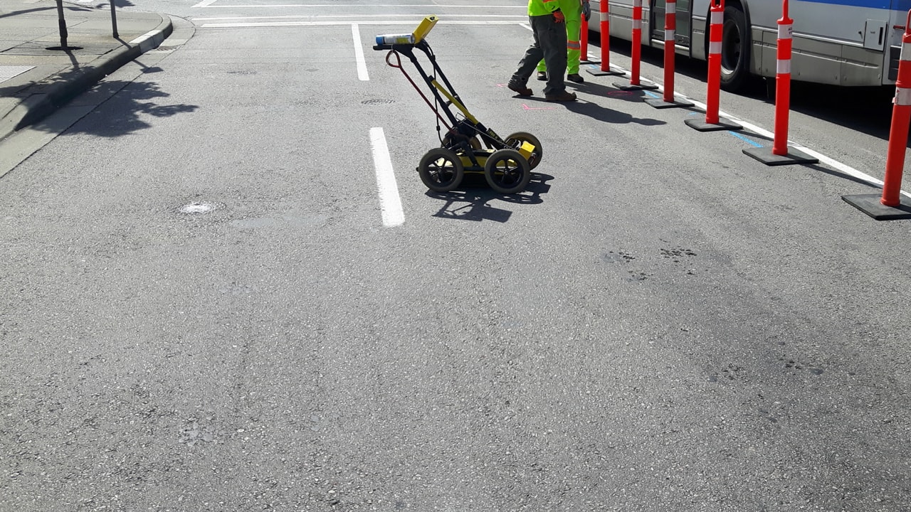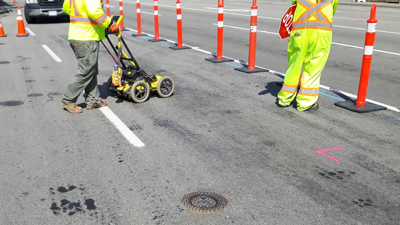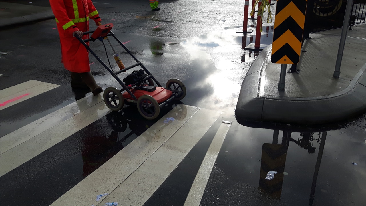
Underground utility locating services are evolving, with technologies like Ground-Penetrating Radar (GPR) at the forefront. While GPR is a powerful tool, its accuracy hinges on various factors.
Let’s delve into the top five factors that influence the precision of GPR in the intricate world beneath our feet.
Five Factors Affecting GPR
The accuracy and effectiveness of GPR in underground utility locating services play an important role to minimize the risk of utility strikes and improve project outcomes.
1. Soil Conditions: The Foundation of Accuracy
The soil beneath our feet isn’t uniform. Variations in soil composition impact GPR signals differently. Soil conditions play a pivotal role in GPR accuracy. Dense soils, like clay, attenuate signals, limiting penetration depth.
Conversely, loose soils allow signals to travel deeper. Understanding the soil composition is essential for interpreting GPR results accurately.
2. Moisture Content: The Hidden Variable
Moisture content in the soil acts as a hidden variable in GPR accuracy. Water alters the dielectric properties of the soil, affecting signal penetration.
High moisture content reduces GPR penetration depth, making it challenging to detect utilities in waterlogged areas. GPR users must account for soil moisture to enhance the precision of their underground scans.
3. Ground Surface and Disturbances: Navigate the Terrain
The ground surface isn’t always smooth, and disturbances can impact GPR accuracy. Surface irregularities, pavement, and debris can cause signal reflections and diffractions.
Construction workers and equipment contribute to ground disturbances, creating challenges for GPR systems. Mitigating these factors ensures a clearer interpretation of the subsurface environment.
4. Type of Soils: Decode the Underground Puzzle
The type of soil is a critical factor influencing GPR accuracy. Different soils possess unique electromagnetic properties, impacting signal behavior.
Natural materials like sand allow for deeper signal penetration, while soils rich in minerals may attenuate signals. Understanding the type of soils present is essential for calibrating GPR equipment and interpreting results accurately.
5. Depth of Penetration: Beyond Surface-Level Insights
GPR’s capabilities vary with the depth of penetration required. Shallow applications offer high-resolution images of near-surface structures, suitable for tasks like locating buried utilities. However, as the depth increases, the resolution decreases.
GPR users must align their expectations with the depth of penetration required for their specific application to ensure optimal results.
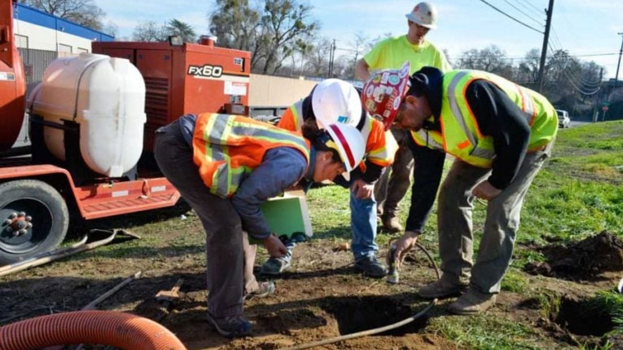
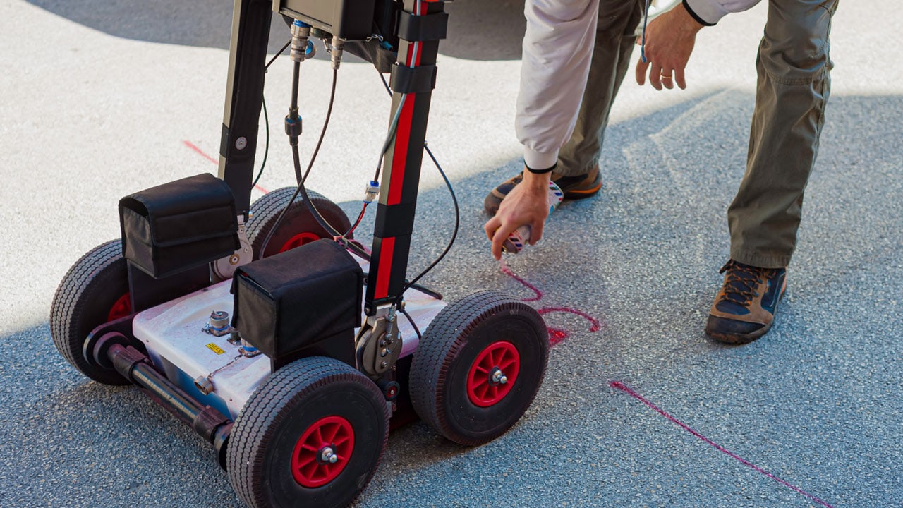
GPR Scanning Services: Navigate Potential Hazards
While GPR is a versatile tool, users must be aware of its limitations. Concrete structures, dense geological features, or the presence of underground objects can impede GPR signals.
Additionally, hidden utilities, especially those made of non-conductive materials, may pose challenges. Collaborating with experienced GPR scanning services is crucial for overcoming potential hazards.
The Role of Utility Companies and Private Utility Locators
Utility companies play a pivotal role in ensuring the accuracy of GPR scans. Their records and collaboration facilitate a more comprehensive understanding of the subsurface environment. However, when dealing with private utilities, the expertise of private utility locators becomes indispensable.
Private locators specialize in identifying non-public utility lines, offering a more complete picture for GPR users.
Balance Wide Range and Accuracy: A GPR Conundrum
GPR systems offer a wide range of applications, from locating subsurface structures to identifying geological features.
However, this versatility comes with a challenge—balancing the wide range with accuracy. Users must understand the specific requirements of their project and tailor GPR settings accordingly to achieve optimal results.
Enhance GPR Accuracy for Construction Projects
Construction projects rely heavily on the accuracy of subsurface information. GPR scanning services ensure that projects proceed without encountering unexpected subsurface challenges.
By considering factors like soil conditions, moisture content, ground surface, type of soil, and depth of penetration, GPR users can enhance the accuracy of their scans and make informed decisions during construction planning.
Hidden Complexities: Subsurface Structures and Geological Features
Beyond the visible surface, a complex network of subsurface structures and geological features exists. GPR serves as a virtual explorer, offering insights into this hidden realm. However, the accuracy of GPR scans is influenced by the composition of these structures.
Denser materials, such as concrete, may hinder signal penetration, necessitating a nuanced approach when scanning areas with extensive subsurface structures.
Concrete Conundrum: Challenges in Urban Environments
Urban environments often pose unique challenges for GPR accuracy. The prevalence of concrete structures in city landscapes can impede signal penetration. Concrete reflects GPR signals, making it challenging to identify utilities or objects beneath.
Skilled interpretation and the use of complementary technologies become crucial in overcoming the concrete conundrum, ensuring accurate results in urban utility locating projects.
Utility Mapping Services: A Holistic Approach
While GPR plays a pivotal role, integrating it with utility mapping services provides a more holistic approach to subsurface exploration. Utility mapping involves comprehensive records search, on-site investigation, and collaboration with utility companies.
By combining GPR technology with utility mapping, a synergy is created, offering a multi-dimensional view of the underground landscape. This approach minimizes the impact of potential inaccuracies associated with individual methods.
Collaboration with Utility Companies: Leverage Existing Records
Utility companies are custodians of valuable information regarding the subsurface infrastructure. Collaboration with these entities is a strategic move to leverage existing records.
By tapping into utility company databases, GPR users gain access to critical data that enhances the accuracy of their scans. This collaboration ensures that utility mapping efforts align with real-world, on-the-ground information.
Private Utility Locators: Bridge the Information Gap
In scenarios involving private utilities, where records may not be as readily available, the expertise of private utility locators becomes invaluable.
These professionals specialize in identifying and marking private utility lines, contributing to a more comprehensive understanding of the subsurface environment. Their role is particularly crucial in projects where public utility records might not provide a complete picture.
Unveil the Depths with Certainty: Secure Your GPR Services Today!
Embark on your construction journey with confidence by leveraging our cutting-edge GPR scanning services. At Util-Locate, we specialize in precision-driven underground utility locating, employing advanced Ground-Penetrating Radar (GPR) technology.
Discover the hidden intricacies beneath the surface before breaking ground, ensuring safety, compliance, and cost-effectiveness. Our team of skilled professionals combines technology with expertise to deliver accurate results in diverse soil conditions and urban landscapes.
Don’t leave your project’s success to chance—partner with Util-Locate for unparalleled GPR services. Take the first step towards a secure and informed construction process—contact us now at 866-638-1075!