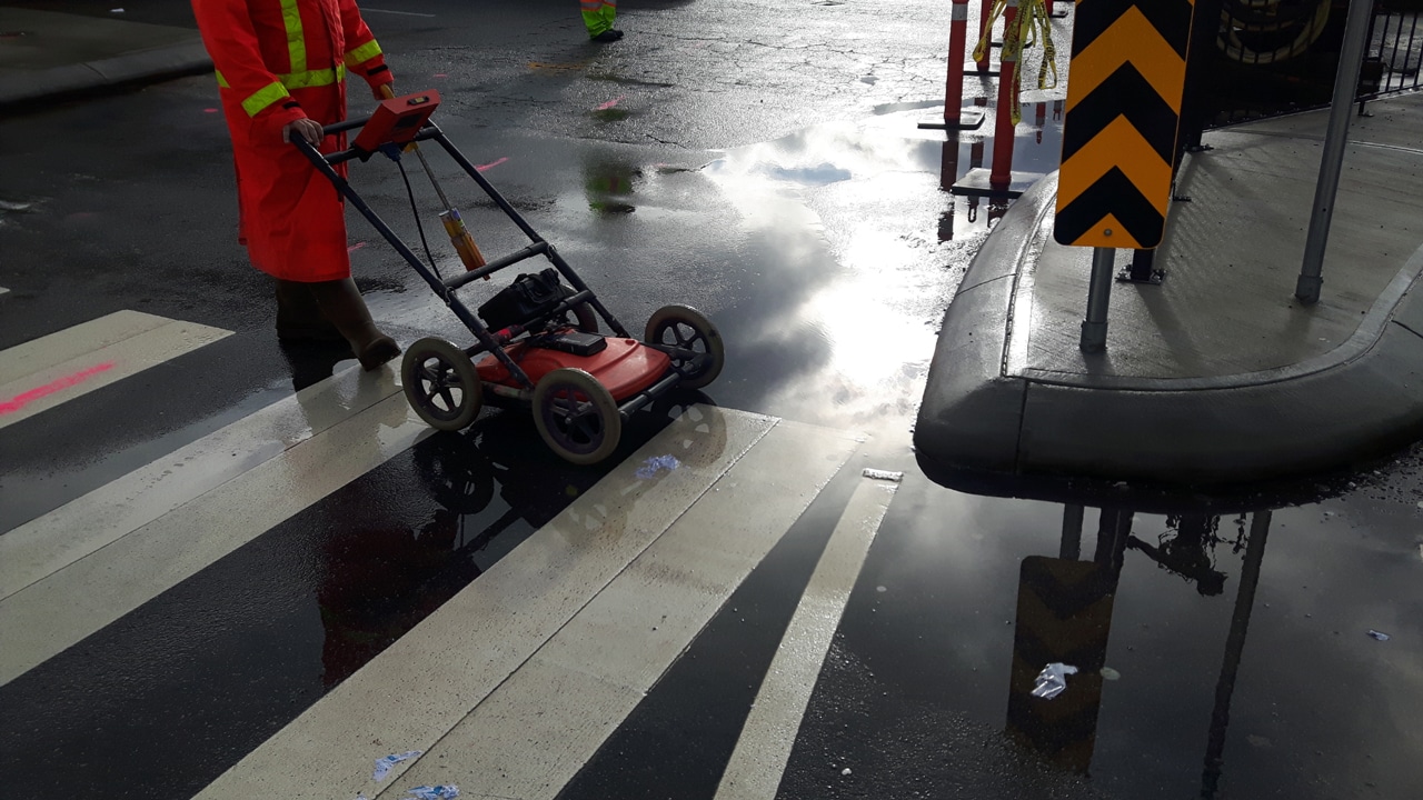
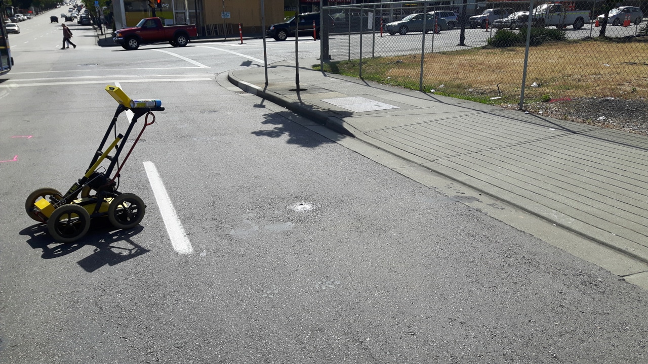
Common Underground Utility Locating Tools and Devices

underground private utility locating

When it comes to construction and excavation projects, the accurate location of underground utilities is crucial to ensuring safety and preventing costly damages. This blog explores the common tools and devices used for underground private utility locating.

From private utility locators to underground wire locators, these tools play a vital role in identifying gas lines, water pipes, electric cables, and other crucial underground infrastructure.

We’ll delve into the importance of precise location techniques, such as using electromagnetic locators and metal detectors, and discuss the advancements in underground utility survey equipment.

By understanding these tools and their functions, professionals in the construction industry can enhance their utility locating practices and minimize risks.

An Insight Into Underground Utility Locating Tools and Instruments

Underground utility locating tools and instruments are essential for construction and excavation projects to identify and avoid potential hazards.

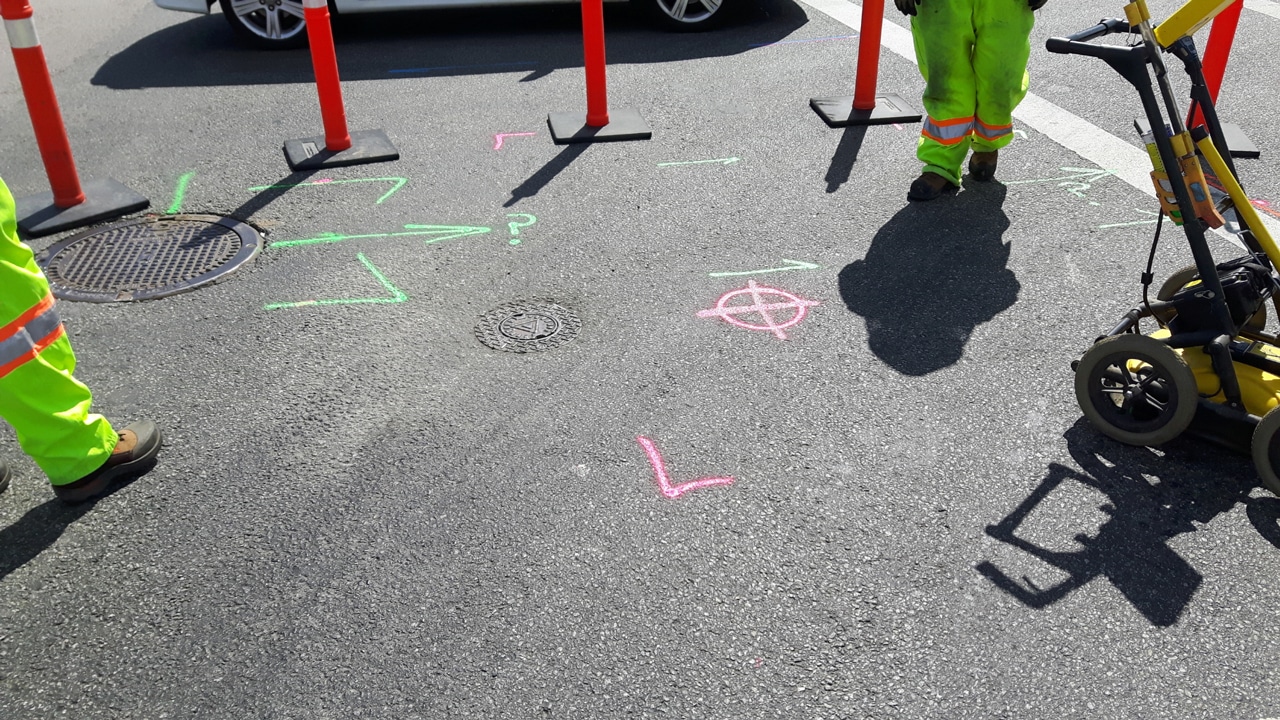
One commonly used tool is the underground utility locator, which utilizes electromagnetic signals to detect underground utilities such as gas lines, water pipes, and electric cables.

These locators employ various technologies, including radio waves and electromagnetic frequencies, to accurately pinpoint the location of buried utilities. Additionally, metal detectors are employed to detect metallic objects like pipes and cables

By using these advanced tools, construction professionals can enhance their ability to locate underground utilities accurately, ensuring the safety and efficiency of their projects.

The Role of Underground Wire Locators in Utility Location

Underground wire locators play a crucial role in utility location, specifically in identifying and tracing underground electrical cables and power lines. These specialized instruments use electromagnetic signals to locate and trace the path of electric currents flowing through underground cables.

By emitting signals and measuring the response, underground wire locators can determine the precise location and direction of buried electric lines, allowing construction crews to work safely and avoid damaging vital infrastructure.

These locators are equipped with features like adjustable frequencies and signal filters to adapt to different soil conditions and environmental factors, enabling accurate and efficient utility location.

Essential Equipment for Locating Metal Pipes and Water Pipes

Locating metal pipes and water pipes underground requires specific tools and equipment. Among the essential instruments used is the pipe locator, which utilizes electromagnetic signals to detect metallic pipes buried beneath the ground.

These locators can differentiate between different types of pipes, such as steel, copper, or PVC, based on their conductive properties. In addition, ground penetrating radar (GPR) systems are employed to create subsurface images and identify the presence and location of various underground features, including water pipes.

By utilizing essential equipment and techniques, construction professionals can precisely locate and avoid damaging metal and water pipes during excavation projects, minimizing disruptions and potential hazards.

Trust Util-Locate to Provide You with Reliable Underground Utility Locating Tools!

When it comes to underground private utility locating, you need tools you can rely on. At Util-Locate, we specialize in providing high-quality and reliable underground utility locating tools and instruments. With our extensive range of equipment, including underground utility locators, wire locators, and pipe locators, we ensure that you have the right tools to accurately detect and locate underground utilities.

Our commitment to excellence and customer satisfaction sets us apart. We offer state-of-the-art technology, expert guidance, and exceptional customer support to meet your utility locating needs. Whether you’re a construction professional or a utility service provider, trust Util-Locate to deliver reliable tools and methods that enhance your efficiency and safety.

Don’t compromise on the accuracy and reliability of your underground private utility locating tools. Contact us at 888-885-6228 at Util-Locate today and experience the difference firsthand!

What is a Ground Penetrating Radar (GPR) & How Does it Work?

Ground penetrating radar

Ground penetrating radar (GPR) is a non-invasive geophysical method used to investigate subsurface materials and structures without damaging the site. It uses high-frequency electromagnetic waves to produce images of the subsurface, which can be used to locate and map buried objects and materials.

This technology has numerous applications, including utility detection, environmental studies, geology, and archaeology.

GPR works by emitting an electromagnetic pulse into the ground using a transmitter antenna. This pulse is then reflected back to the surface by subsurface objects and recorded by a receiver antenna.

By analyzing the characteristics of the reflected wave, GPR can provide information about the depth, size, and shape of subsurface features.

GPR is a powerful tool that can penetrate a variety of materials, including soil, rock, concrete, and ice. It is non-destructive, fast, and accurate, making it an essential tool for many industries. This article will explore the principles of GPR, how it works, and its many applications. We will also discuss the limitations of GPR and the factors that can affect its performance.

Definition of Ground Penetrating Radar

Ground-penetrating radar is a geophysical method that uses electromagnetic energy to detect and map subsurface features. This technology is commonly used for a variety of applications, including locating buried utilities, identifying geological features, and detecting archaeological artifacts.

It works by sending short pulses of electromagnetic energy into the ground and measuring the time it takes for the energy to reflect back to the surface. By analyzing the reflected signals, GPR can create a detailed image of the subsurface structure.

The Physics Behind GPR: Electromagnetic Energy and Radar Waves

GPR relies on the properties of electromagnetic energy and radar waves to detect subsurface features. Electromagnetic energy is a form of energy that is created when an electric field and a magnetic field interact.

When this energy is sent into the ground, it interacts with subsurface objects that have different electrical properties. The radar waves produced by the interaction of electromagnetic energy and subsurface objects are then reflected back to the surface, where they can be detected and analyzed.

GPR Components: Antennas, Control Unit, and Radar Signal

GPR systems consist of three main components: antennas, a control unit, and a radar signal. Antennas are used to transmit and receive the electromagnetic energy that is sent into the ground.

The control unit is the central component of the system and is responsible for generating and analyzing the radar signal. The radar signal is the electrical signal that is produced by the control unit and sent to the antennas. By analyzing the radar signal, GPR can create a detailed image of the subsurface structure.

How GPR Works: Depth of Penetration and Subsurface Structures

The depth of penetration of GPR waves depends on several factors, including the electrical conductivity of the ground, the frequency of the antennas used, and the dielectric properties of the subsurface structures. The depth of penetration can vary from a few centimeters to several meters, depending on the favorable conditions for the radar signal to travel through the ground.

GPR is capable of detecting a wide range of subsurface structures, including buried utilities, pipes, archaeological artifacts, and geological features. By analyzing the radar data, it is possible to create a detailed image of the subsurface structures, which can be used to identify potential hazards or locate valuable resources.

GPR Data Displays: 2-D and 3-D Views

The data collected by GPR is typically displayed in 2-D or 3-D views, which provide a detailed image of the subsurface structures. In 2-D scans, the data is displayed as a horizontal slice of the ground at a specific depth, while in 3-D displays, the data is presented as a block view of the subsurface structures.

The accuracy of the depth of investigation depends on several factors, including the type of soil, the antenna frequency, and the actual depth of the subsurface structure. 3-D displays can provide more accurate and detailed information about the subsurface structures, allowing for better decision-making and planning in a variety of industries.

These displays are commonly used in construction, geology, archaeology, and environmental studies, providing valuable insights into the subsurface conditions and helping to ensure the safety and efficiency of a project.

Factors Affecting GPR Performance: Conductive Properties and Ground Disturbances

The accuracy and effectiveness of GPR depend on several factors, including the electrical conductivity of the soil or material being scanned and the presence of any ground disturbances.

Conductivity in the ground affects the propagation of radar waves, and therefore the depth of penetration and quality of the signal. High-conductivity materials such as metals, wet soil, and water can absorb electromagnetic energy, leading to signal attenuation and reduced penetration depth.

Ground disturbances such as pipes, cables, or construction activities can also affect the performance of GPR. When the ground surface is not uniform, or when there are subsurface structures with different electromagnetic properties, the radar waves can reflect or refract, causing noise and reducing the accuracy of the results.

To minimize the impact of these factors, GPR operators can perform surveys in favorable conditions, such as dry soil and low-conductivity materials. They can also use specialized antennas and software to filter out noise and enhance the quality of the data.

Choose Util-Locate for Your Ground Penetrating Radar Service Needs

Looking for reliable and accurate ground penetrating radar services? Look no further than Util-Locate! Our team of experienced professionals is equipped with state-of-the-art GPR equipment and is committed to providing you with the best possible results.

Whether you need to locate subsurface utilities or assess the condition of concrete structures, our GPR services can provide the information you need to make informed decisions.

With our proven track record of success and commitment to customer satisfaction, you can trust us to deliver quality ground-penetrating radar services that meet your needs and exceed your expectations. To learn more and to schedule your GPR service, contact us at 888-885-6228 at Util-Locate today!

What is Potholing and Why is it Necessary in Underground Construction?

Utility potholing

Utility potholing is a crucial process in underground construction, helping to ensure that workers can safely and accurately excavate the ground without damaging critical infrastructure such as utility lines. In this blog, we’ll provide a comprehensive overview of potholing and its importance in construction projects.

We’ll explain what potholing is, how it works, and the equipment used in the process. We’ll also cover the benefits of using potholing services, including increased safety, cost savings, and reduced downtime.

By the end of this blog, you’ll have a clear understanding of why potholing is necessary and how it can help you complete your underground construction projects efficiently and effectively.

The Basics of Utility Potholing and Importance in Underground Construction

Potholing, also known as daylighting, is the process of excavating small holes in the ground to locate underground utilities and other infrastructure. This process is critical in the construction industry, as it helps to prevent costly and dangerous accidents that can result from accidentally striking an underground utility line. Potholing is particularly important in areas where underground utilities are not accurately mapped or the information on utility maps is outdated.

The preferred method of potholing is vacuum excavation, which uses high-pressure air or water to break up the ground and a vacuum to remove the soil, debris, and water. This method is more efficient and safer than traditional excavation methods that use heavy equipment, which can cause damage to the underground infrastructure.

The Benefits of Potholing for Underground Construction Projects

Potholing offers numerous benefits for construction projects involving underground infrastructure. It helps to accurately locate the exact location of underground utility lines, fiber optics, and other subsurface features, reducing the risk of damage during the excavation process. Potholing also allows for the identification of incorrect utility locations, reducing the risk of utility damage and costly repairs.

By identifying the precise locations of underground services, potholing helps to prevent service interruptions during construction, which can result in significant costs and delays. Additionally, potholing provides cost savings by limiting costs associated with expensive equipment and by keeping projects within budget.

Understanding the Potholing Process: Techniques and Methods

The potholing process involves several techniques and methods that help to accurately locate and excavate underground infrastructure. This includes the use of the ground-penetrating radar (GPR) which provides information on subsurface features, as well as the use of directional drilling, which is used to bore holes and install underground service lines.

The most common method of potholing is air vacuum excavation, which involves the use of a portable vacuum excavator to break up the ground and remove soil, debris, and water. Other potholing techniques include water excavation, which uses pressurized water to break up the ground, and boring holes, which are used to install underground service lines.

Trust the Experts: Why Util-Locate is Your Top Choice for Potholing Services

Util-Locate is a trusted provider of potholing services and has extensive experience in the potholing process. Our team of experts is highly trained in the use of the latest potholing techniques and methods, ensuring accurate and efficient excavation of underground infrastructure.

Util-Locate uses the latest technology and equipment, including ground-penetrating radar and air vacuum excavation, to accurately locate and excavate underground utilities and other subsurface features. Our team is dedicated to providing the highest level of service and ensuring that every project is completed safely, on time, and within budget.

By choosing Util-Locate for your potholing needs, you can trust that your project is in the hands of experts who understand the importance of accurate and efficient excavation of underground infrastructure.

For reliable potholing services, contact us at 888-885-6228 at Util-Locate today!

The Basics of Potholing Construction and its Importance in Excavation Projects

potholing services

Potholing is a crucial process in excavation projects that involves creating a small, precise hole to locate and identify the exact position of underground utilities, such as fiber optic lines and utility poles. By using specialized equipment like vacuum excavation, potholing services are able to accurately identify and map the horizontal position and depth of these utilities, reducing the risk of damage and service interruptions during the construction process.

This blog post will cover the basics of potholing construction and its importance in excavation projects, including the potholing process, methods of utility location, and the role of subsurface utility engineering in ensuring that underground infrastructure is not damaged during construction.

What is Potholing and Why is it Important in Excavation Projects?

Potholing is a process of creating a small, precise hole to expose and identify the location of underground utilities. This process is important in excavation projects because it allows construction crews to locate and identify the exact location of underground utility lines, fiber optic lines, and other infrastructure, reducing the risk of damage and service interruptions during the construction process.

Potholing services use specialized equipment like vacuum excavation to accurately locate and map the horizontal position and depth of underground utilities. By using these advanced techniques, construction crews can avoid the risk of damaging underground infrastructure during the excavation process, which can be costly and time-consuming to repair.

In addition, potholing helps prevent service interruptions by ensuring that construction crews are aware of the exact locations of underground utilities. This knowledge allows them to plan the construction process more effectively and avoid any potential issues that may arise during excavation.

This is an essential process in excavation projects, and its importance cannot be overstated in preventing underground utility damage and service interruptions.

The Benefits of Vacuum Excavation for Locating Underground Utilities

Vacuum excavation is a non-destructive excavation method that is commonly used to locate underground utilities. This process involves the use of specialized equipment that utilizes compressed air or water to loosen the soil and a vacuum system to remove the loosened soil and debris.

One of the main benefits of vacuum excavation is its precision. The use of compressed air or water allows for a more controlled excavation, making it easier to locate underground utilities without causing damage to them.

Furthermore, vacuum excavation is a safer alternative to traditional excavation methods, as it reduces the risk of injury to construction crews and damage to underground infrastructure.

The Role of Subsurface Utility Engineering in the Potholing Process

Subsurface Utility Engineering (SUE) plays a critical role in the potholing process. SUE involves using advanced technologies to map and locate underground utilities and other infrastructure to a high degree of accuracy. By utilizing this technology, potholing services can provide construction crews with precise information about the location and depth of underground utilities, reducing the risk of damage during the excavation process.

SUE technologies include electromagnetic locators, ground-penetrating radar, and other geophysical instruments. These tools can provide construction crews with detailed information about the location and type of underground utility lines, such as water, gas, or electricity.

By incorporating SUE into the potholing process, construction crews can make informed decisions about the location and depth of underground utilities, reducing the risk of service interruptions and damage to underground infrastructure.

Trust Util-Locate to Handle Your Potholing Construction and Excavation Projects

When it comes to potholing construction and excavation projects, it’s essential to work with a company that you can trust. Util-Locate has over 20 years of experience providing quality potholing services and underground utility locating services to a wide range of industries.

Our team of experienced professionals utilizes state-of-the-art equipment and technology to accurately and safely locate underground utilities, reducing the risk of damage and service interruptions during the excavation process. We understand the importance of timely and efficient project completion, and we work closely with our clients to ensure their needs are met.

Trust Util-Locate to handle your utility potholing construction and excavation projects. To learn more about our services and how we can help with your next project, contact us at 888-885-6228 at Util-Locate today!

The Science Behind CCTV Pipe Inspection

CCTV pipe inspection

Having a damaged pipe can result in a myriad of terrible inconveniences and CCTV pipe inspection is a fantastic means to utilize technology to get to the root of every problem.

If the problem lies in the sewer pipe, this could cause nearby areas to clog and produce a foul odor. Drainage systems that are not working correctly could cause temporary flooding that damages nearby property and poses a potential danger to nearby people.

What is a Pipe Inspection?

The process of inspecting a pipe is done to locate faults and damages that may affect the overall quality and efficiency of a pipe. These damages can be caused by a number of issues that include:

  • Roots from nearby trees and plants
  • Cracks
  • Corrosion
  • Wear and tear that has caused damage over time
  • Blockage
  • Damage due to natural disasters

There is a range of other potential damages that may have occurred. Internal inspection is often needed to understand what is causing the pipe to fail and what the next best actions are.

There are many methods of inspection, but none prove as useful and effective as CCTV pipe inspection.

Benefits of a Pipe Inspection

Inspecting a possibly severely damaged pipe is essential in solving the problems that it may cause. In some serious cases, prolonged damage can cause a range of negative side effects such as extreme health risks and damage to property.

The pipe inspection process is often a quick and easy one that provides the information necessary to handle the problem at large.

How are CCTV Cameras Used?

Technology is a wonderful tool in our modern world. When inspecting a pipe, small CCTV cameras are used to check the condition of the pipe. These cameras are often inserted into manholes, utility holes, and entry points as they scan the pipe’s quality and health.

The footage is then relayed back to the operator who can adjust the camera further to check on the full extent of the damage.

What is the Footage For?

The footage is gathered as a good means of accurate mapping information. This information allows the homeowner, utility repair company, and any other services that may need the footage, to accurately identify the cause of damage.

This is done by closely analyzing the video frames that have been recorded via the camera. When this cause is identified, an effective solution can be created. Without this information, it is difficult to understand what work is needed and what form of damage the underground sewer pipe faces.

Hire the Right Team to Conduct a CCTV Pipe Inspection

Getting the right team for the job is essential. Util-Locate is a specialist in underground utility locating, sewer damage detection, and CCTV pipe inspection.

By utilizing state-of-the-art technology, our team is able to provide a service that truly gives you the tools and information you need in order to effectively and efficiently conduct various tasks.

Partnering with an industry leader means that the service is always quality-assured and accurate. If you think that your pipes may need an inspection, get in touch with us and have our professional team inspect them and get down to the root of every problem.

Contact us at 888-885-6228 at Util-Locate today!

GPR Vs. Traditional Surveying Methods: Which One is Better for Your Project?

Ground penetrating radar

Before going about any construction or excavation process, it is essential to conduct a utility surveying process. Ground penetrating radar (GPR) has become a common and widely used method to locate underground utilities.

This has many different benefits, and over time the technology has evolved to be more precise and efficient. Let’s have a closer look at what utility surveying is, and the differences between traditional methods and GPR.

What is Utility Surveying?

Utility surveying is the process of ensuring that no underground utility lines, such as water pipes and electricity lines, are present before excavating or constructing over a specified area.

Damage to these lines can cause some serious destruction, property damage, and complications while posing a health risk to workers. Utility surveying is an important process for any excavation or construction project so that the task can be completed without complications.

Benefits of Utility Surveying

There are many benefits to utility surveying. Some of these benefits include:

  • Less risk of soil disturbances
  • Fewer project delays
  • Easier and more informed decision-making
  • Lowered risk of personal injury
  • Minimized monetary loss from construction projects and excavation sites.

These benefits are great to keep in mind as it assists not only in lowering the overall risk of unforeseen costs but also the threat of injury while working on the site.

Different Types of Utility Surveying

A utility surveying company will often employ various different methods to detect subsurface utilities. These methods can include GPR, potholing, or dowsing. Having a good understanding of each will assist you in choosing the right one for your project.

Ground Penetration Radar

GPR is used for subsurface utility line locating. This method uses high-frequency radio wave pulses that are emitted into the ground and bounce off covered facilities. When these waves deflect, they return back to the operator who gets a good understanding of where the utilities may be hidden.

Some of the limitations that GPR may have include factors such as soil density, distance, and soil type. GPR is commonly used alongside electromagnetic (EM) locating which makes up for any disadvantages that it has.

Traditional Methods

The traditional methods of utility locating include potholing and dowsing. Potholing is a process of using a high-pressure vacuum excavation device to break the soil and reveal the utilities. Dowsing is a process in which dowsing rods are inserted into the ground in an attempt to locate hidden utilities. 

GPR or Traditional?

While the traditional methods are reliable, GPR proves to be more efficient. With GPR and EM, lines are more accurately found with little to no ground disturbances. This makes the task far easier whilst also receiving accurate indications of where the utilities may be.

Get the Right Ground Penetrating Radar Service for the Job

Getting the right assistance for the task is an essential tool for any construction and excavation project.

Without help from a professional team of expert surveyors like Util-Locate, a site could have many disturbances that affect the overall productivity and efficiency of its workers.

Get in touch with our team and receive industry-leading utility locating and ground-penetrating radar services that efficiently uncover your hidden utilities. Contact us at 888-885-6228 at Util-Locate today!