Utility Locating Methods: Identifying Underground Electrical Lines

utility locating to identify underground electrical lines

Key Takeaways:

  • Accurately identifying underground electrical lines is crucial for preventing accidents, avoiding costly damages, and ensuring the safety of construction projects.
  • The article explores both traditional techniques like visual inspection and historical records, as well as advanced technologies such as electromagnetic locators, ground penetrating radar (GPR), and radio frequency identification (RFID).
  • Hiring experts can provide accurate results, reduce risks, and ensure compliance with regulations.
  • Modern tools like electromagnetic locators and GPR offer precise and efficient methods for locating underground utilities.
  • Accurate maps of underground infrastructure are essential for safe and sustainable urban development.

In today’s complex urban environments, the presence of underground utilities, particularly electrical lines, poses significant challenges for construction and renovation projects. Utility locating has become an indispensable practice to ensure safety, prevent costly damages, and maintain the integrity of existing infrastructure.

This comprehensive guide will explore various methods used in utility locating to identify underground electrical lines, from traditional techniques to cutting-edge technologies.

Utility Locating

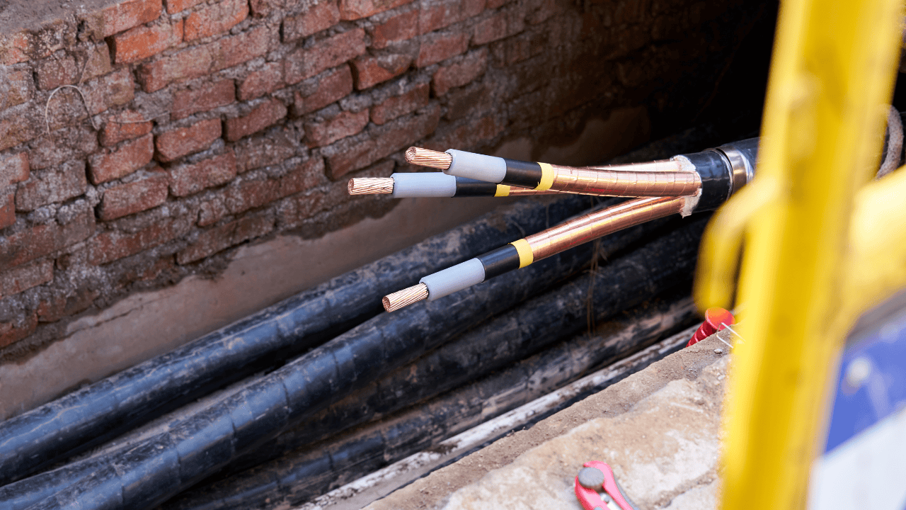
Underground electrical lines are the lifeblood of our modern infrastructure, silently powering homes, businesses, and public spaces. However, these hidden networks can pose serious risks if accidentally damaged during excavation or construction activities.

This is where the critical practice of utility locating comes into play. By employing a range of methods and technologies, professionals can accurately identify and map underground electrical lines, ensuring safe and efficient project execution.

Traditional Methods of Locating Buried Electrical Lines

Before the advent of modern technology, locating underground utilities relied heavily on manual techniques and basic tools. While these methods may seem outdated, they still play a crucial role in utility location, especially when used in conjunction with more advanced technologies.

1. Visual Inspection

One of the simplest yet often overlooked methods is visual inspection. Experienced utility locators can identify above-ground indicators of underground electrical lines, such as:

  • Utility poles and overhead lines
  • Transformer boxes
  • Meter boxes
  • Manhole covers
  • Pavement cuts or patches

These visual cues can provide valuable initial insights into the potential location of underground electrical infrastructure.

2. Historical Records and As-Built Drawings

Utility companies and local municipalities often maintain records of underground utility installations. These historical documents, including as-built drawings and infrastructure maps, can offer a starting point for locating buried electrical lines. However, it’s important to note that these records may not always be up-to-date or accurate, especially in older areas where multiple infrastructure changes have occurred over time.

3. Magnetic Locators

Magnetic locators are handheld devices that detect the magnetic fields generated by ferrous metals. While not specifically designed for locating electrical lines, they can help identify metal conduits or pipes that may house electrical cables. This method is particularly useful for locating shallow utilities but becomes less effective as depth increases.

Modern Technologies for Locating Buried Electrical Lines

Advancements in technology have revolutionized the field of utility locating, offering more precise and efficient tools and devices for identifying underground electrical lines.

1. Electromagnetic Locators

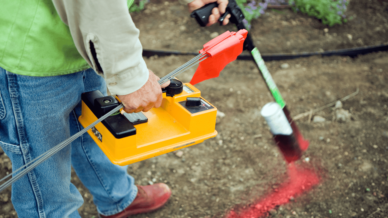
Electromagnetic (EM) locators are among the most widely used tools in modern utility locating services. These devices consist of two main components:

  • A transmitter that induces an electromagnetic signal into the utility line
  • A receiver that detects the signal and helps trace the path of the utility

EM locators are highly effective for locating conductive utilities, including electrical lines. They can provide information on the depth and direction of the utility, making them invaluable for creating accurate utility maps.

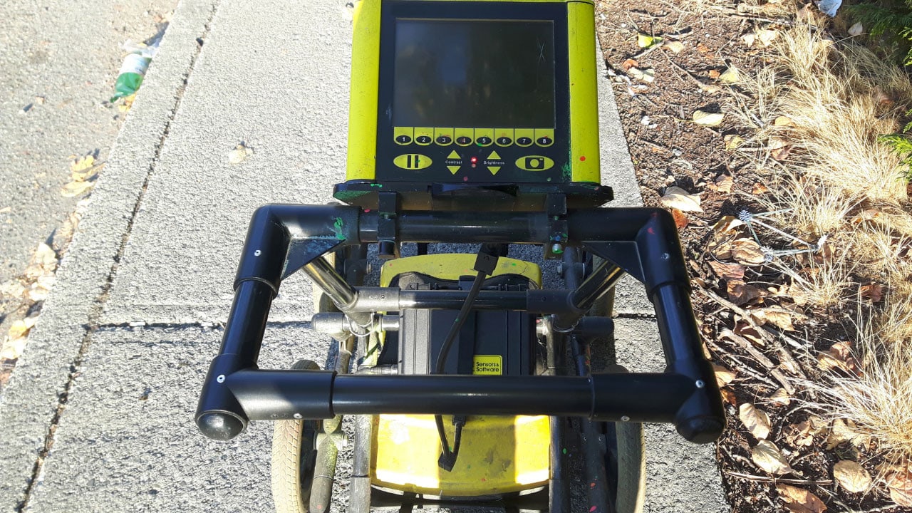
2. Ground Penetrating Radar (GPR)

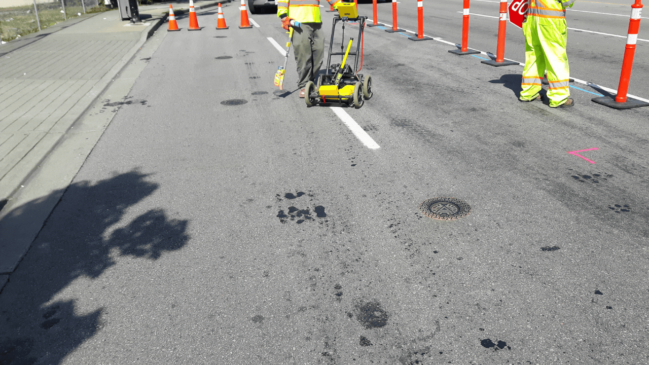
Ground Penetrating Radar has emerged as a powerful tool in underground utility locating. GPR works by emitting high-frequency radio waves into the ground and analyzing the reflections to create a subsurface image. This technology offers several advantages:

  • It can detect both metallic and non-metallic utilities
  • It provides a comprehensive view of subsurface conditions
  • It can identify utilities at various depths

GPR is particularly useful in complex urban environments where multiple utilities may be present at different depths.

3. Radio Frequency Identification (RFID)

RFID technology is gaining traction in utility locating, especially for newly installed infrastructure. RFID tags can be attached to utility lines during installation, allowing for easy and accurate location in the future. This method offers:

  • Precise location information
  • Data storage capabilities for utility specifications
  • Long-term durability

While RFID is not yet widespread for existing utilities, it represents a promising future direction for utility management and location.

4. Acoustic Pipeline Locators

Although primarily used for water and gas lines, acoustic pipeline locators can sometimes assist in locating electrical conduits, especially when used in conjunction with other methods. These devices detect the sound waves propagating through pipes or conduits, helping to trace their path underground.

Why Hire a Professional Utility Locating Company to Locate Buried Power Lines

While some of these methods may seem straightforward, locating underground electrical lines is a complex task that requires expertise, specialized equipment, and a comprehensive understanding of local infrastructure. Here are several compelling reasons to hire a professional utility locating service:

1. Expertise and Experience

Professional utility locators bring years of experience and specialized knowledge to the table. They understand the nuances of different locating methods and can choose the most appropriate techniques for each specific situation. Their expertise allows them to interpret data accurately, reducing the risk of misidentification or missed utilities.

2. Advanced Equipment

Professional utility locating companies invest in state-of-the-art equipment that may be too costly or impractical for individual contractors or homeowners to purchase. This advanced technology ensures more accurate and comprehensive utility detection.

3. Safety Assurance

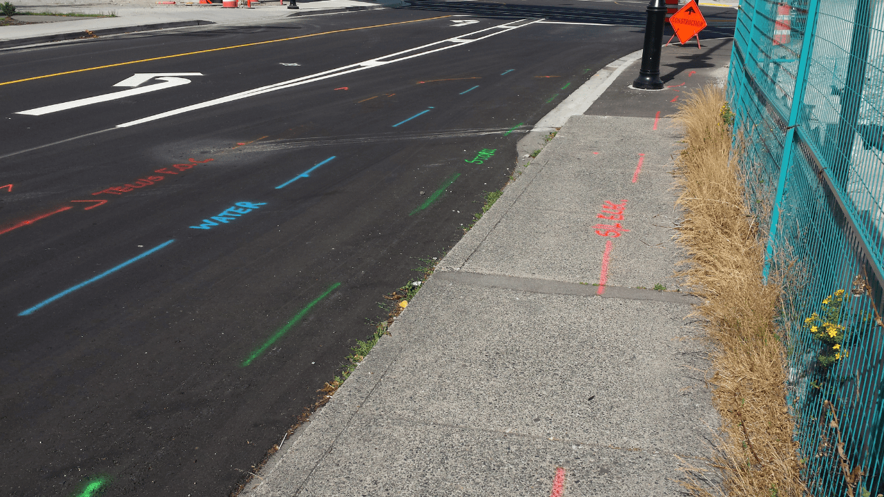
Incorrectly identified or undetected electrical lines pose severe safety risks. Professional utility locators prioritize safety and follow strict protocols to ensure all utilities are accurately located and marked, significantly reducing the risk of accidents during excavation or construction.

4. Cost-Effective in the Long Run

While hiring a utility locating service may seem like an additional expense, it can save significant costs in the long run by preventing utility damage, project delays, and potential legal issues associated with utility strikes.

5. Compliance with Regulations

Professional utility locators are well-versed in local, state, and federal regulations regarding underground utility detection and excavation. They ensure that all locating activities comply with these regulations, protecting you from potential legal and financial liabilities.

Ready to Protect Your Site?

Ensure the safety and efficiency of your projects with cutting-edge utility locating technology. At Util-Locate, we offer comprehensive utility locating services that leverage advanced techniques to identify underground electrical lines and other utilities accurately.

Contact us today to learn how our expertise can benefit your construction or excavation projects in California and keep you compliant with all regulations. Protect your site, your workers, and the community with Util-Locate’s professional utility locating services. Don’t leave the safety of your project to chance. Invest in expert utility locations for peace of mind and project success.

Residential Projects that Require Utility Locating Services To Ensure Safety Befor Digging

Do you have a residential project involving excavation? Hire Util-Locate for professional underground utility locating service to ensure safety.

Key Takeaways

  • Before starting any digging or construction project, it’s crucial to locate underground utilities to avoid accidents and costly repairs.
  • Major residential projects like installing fences, landscaping, building additions, and expanding driveways all need utility locating to ensure safety.
  • Professional utility locating services help prevent hitting gas lines, water pipes, or electrical cables, which can lead to severe accidents and expensive repairs.
  • Utility locators use advanced technology like ground-penetrating radar (GPR) and electromagnetic equipment to accurately find and mark underground utilities.
  • Hiring a professional utility locating service can save you time and prevent costly mistakes by quickly and efficiently marking the location of utilities.

If you’re planning any type of digging or construction work around your home, there’s one thing you need to do before anything else, and that is to locate the underground utilities. May it be a tree plantation, building a deck, or installing a new fence, knowing what’s beneath the ground is important. Hitting a gas line, water pipe, or electrical cable can lead to serious accidents, costly repairs, and even legal trouble.

But don’t worry. Utility locating services are here to help you avoid such risks. But what exactly are these services, and when do you need them? Let’s get started.

What is Utility Locating?

Utility locating is all about finding and marking the position of underground utilities like gas, water, electric, and sewer lines. They help you know where it’s safe to dig and where you need to be careful in order to avoid any potential harm. Utility locators use various technology, tools, and expertise to pinpoint the precise location of these underground utilities.

Utility locating in California is especially important due to the densely packed infrastructure and varying terrain. That’s where it becomes crucial to understand when you might need professional expertise

Major Projects that Need Private Utility Locating Services

Though any digging project should not proceed without the proper utility detection, however, there are few residential projects where utility locating services become the need of the hour. Here are some of the most common ones:

  • Installing a Fence or Deck

When you’re setting up a new fence or deck at your home, you’ll need to dig deep enough to place the posts securely. But before you grab that shovel, it’s important to know what’s below. 

There could be gas lines, electrical cables, or water pipes in your way. Utility locators can help you avoid hitting these utilities and prevent any disruptions to your home or neighborhood.

  • Landscaping and Tree Planting

Landscaping might seem simple, but when you’re planting trees or large shrubs, you’re likely digging deeper than usual. If there’s a water main or gas line running through your yard, it could be right where you plan to plant. Using a utility locating service will help ensure you don’t hit any of these crucial lines.

  • Building an Addition or Garage

Adding an extra room or garage to your home is a big project. It often requires extensive digging for foundations, and there’s a high chance you’ll encounter underground utilities. Before any digging starts, it’s crucial to have a utility location done to avoid any potential hazards. 

  • Pool Installation

Planning to install a swimming pool in your backyard? It may involve digging out a large area. With such a big project, there’s a good chance you’ll run into underground utilities. Underground utility locating services will help map out these lines, so you know where it’s safe to dig. It’s a small step that can save you from major headaches down the line.

  • Installing Sprinkler Systems

If you’re adding a sprinkler system to your yard, you’ll need to dig trenches for the pipes. Since sprinkler systems require you to dig in multiple locations across your yard, the chances of hitting a utility line are higher. Hiring a professional to handle the utility locating will help you avoid damaging any underground utilities.

  • Driveway Expansion

Expanding your driveway might appear straightforward, but it often involves more digging than you’d think. Whether you’re adding space for an extra car or simply making it wider, you’ll need to know where the utilities are. Utility locating services are crucial here to keep your project safe by avoiding any potential damage.

Hiring a Professional Utility Locating Service

You might be tempted to skip the utility locating step, especially if your project appears simple. But the truth is, you never know what’s underground until you check. Hiring a private utility locating service is a wise decision, and here’s why:

  • Accuracy and Safety

Professional utility locators have the tools and expertise to accurately locate underground utilities. They use advanced technology like ground-penetrating radar (GPR) and electromagnetic equipment to detect utilities, even if they’re not metallic. This accuracy ensures that you avoid hitting anything that could cause harm or damage.

  • Preventing Costly Mistakes

Imagine hitting a gas line while digging in your yard. The costs of repairing the damage, not to mention the potential fines and legal issues, can add up quickly. By using a utility locating service, you can prevent these costly mistakes from happening in the first place. It’s an investment that pays off by keeping your project on track and your budget intact.

  • Time-Saving

Hiring a professional can save you time in the long run. Instead of trying to guess where the utilities are or waiting for a utility company to come out, a private utility locator can quickly and efficiently mark the utilities for you. This allows you to move forward with your project without unnecessary delays.

Why Utility Locating Should Be Your First Step in Any Residential Project

In any residential project that involves digging or construction, it’s important to locate the utilities first. Whether you’re installing a fence, building an addition, or putting in a pool, knowing what’s underground will help you avoid accidents, save money, and keep your project on track.

Invest in Safety & Success: Hire a Professional Utility Locating Service

Don’t take chances with your safety or your home. If you’re planning a project, get in touch with a professional utility locating service like Util-locate today. It’s a small step that makes a big difference in ensuring your project goes smoothly and safely.

Gas Line Locating: How to Find Underground Gas and Oil Supply Pipelines

utility locating

Key Takeaways:

  • Striking a buried gas line can lead to dangerous situations, including explosions and costly repairs. Always locate gas lines before digging.
  • Professional utility locating services are critical for accurately finding underground gas and oil pipelines, especially in areas like California.
  • There are multiple methods for locating gas lines, including electromagnetic locating, Ground Penetrating Radar (GPR), vacuum excavation, and marker balls.
  • Professionals use specialized tools like pipe and cable locators, GPR systems, electromagnetic conductive tracers, and gas detection instruments to ensure accurate gas line detection.
  • Properly locating gas lines before any construction work can prevent accidents, save money, and protect the safety of everyone involved.

Before you plan to dig or do any construction work, it’s important to know where underground gas and oil pipelines are. Striking a buried gas line can lead to severe consequences, like costly repairs or even life-threatening accidents. 

This blog guides you to every detail you need to know about finding underground gas and oil supply pipelines and why utility locating is a must.

What Happens if You Hit a Buried Gas Line?

Striking a buried gas line accidentally is an unimaginable situation anyone definitely wants to avoid. If a gas line is hit, it can cause a leak, leading to dangerous gas buildup. This can result in explosions, fires, or even deadly carbon monoxide poisoning.

Beyond the safety risks, there are also hefty fines and repair costs that could come your way. Plus, damaging a gas line could disrupt service to homes or businesses in the area, causing problems not just for you, but for the whole community.

This is where utility locating services come to your rescue. Before you dig, it’s essential to know exactly where those lines are to keep everyone safe and avoid unexpected costs. If you’re in California, for example, utility locating in California is a service that can help pinpoint the exact location of these underground utilities.

Methods to Locate Gas Lines

There are multiple methods to locate underground gas and oil pipelines. Most of them involve multiple technological advancements and skilled professionals.

  1. Electromagnetic Locating: This is one of the most common methods. It involves sending an electromagnetic signal through the underground utility. The signal can then be detected by a receiver above ground. It’s accurate for finding metallic pipelines and is widely used by utility locators.
  2. Ground Penetrating Radar (GPR): GPR is another method that’s often used where electromagnetic locating isn’t possible, such as with non-metallic pipes. GPR sends radar waves into the ground, and when these waves hit a buried object, they bounce back to the detecting surface. The data is then interpreted to reveal the location and depth of the pipeline.
  3. Vacuum Excavation: Unlike other detecting or locating methods this method is more of a verification method. Once the relevant authorities or professional services have detected the pipeline, vacuum excavation comes in. It involves digging a small, controlled hole to visually confirm the pipeline’s location. This is often used when extreme accuracy is needed, particularly in congested areas.
  4. Marker Balls: Some of the modern pipelines are installed with marker balls that emit a signal detectable by specialized equipment. This method is useful for pipelines that are particularly deep or in areas where other methods might be less effective.

For a more detailed look into these methods, check out this resource on utility locating.

Tools for Locating Underground Gas Lines

Professional utility locating services and gas line locating uses a variety of tools to locate underground gas lines. Each tool is used for different situations and types of pipelines.

  1. Pipe and Cable Locators: These are handheld devices that can detect the electromagnetic signals emitted from underground utilities. They are versatile and are often the go-to tool for many professional utility locating services.
  2. GPR Systems: Ground Penetrating Radar systems are more complex but they are incredibly useful for detecting non-metallic pipes made from plastic or composite materials. GPR systems come in various sizes, from handheld devices to larger, cart-mounted units.
  3. Electromagnetic Conductive Tracers: These tracers are used to detect non-metallic pipes by an electromagnetic locator. They work by placing a conductive wire along or inside the pipeline, allowing it to be found using standard electromagnetic locating tools.
  4. Gas Detection Instruments: In cases where a gas leak is suspected, gas detection instruments can sniff out the presence of gas in the soil or air. These tools are extremely useful in emergency situations where a quick response is critical.

Why is it Crucial to Locate a Gas Pipeline?

Locating gas lines before digging isn’t just a safe idea, it’s a necessity. The consequences of hitting a gas line can be severe, both in terms of safety and costs. Taking the time to use utility location services can save you a lot of trouble down the line.

Accidents like the Murrieta explosion could have been prevented with proper locating services.

Protect Your Project: Locating Underground Gas Lines with Util-Locate!

Whether you’re planning a residential DIY project or a contractor working on a larger scale construction site, knowing the location of underground gas lines is critical. Using the right methods and tools can help us avoid accidents, save money, and ensure the safety of everyone involved.

Remember, when it comes to gas line locating, it’s better to be safe than sorry. For more tips and services related to utility locating, explore utility locating services in your area. 

If you’re ever in doubt, reach out to Util Locate for professional assistance. We have the expertise and equipment to keep your project safe and on track.

Water Line Locators: Locating Underground Hazards Before Digging

utility locating services

Key Takeaways:

  • Locating underground water lines before digging prevents accidental damage, costly repairs, and project delays.
  • Different water pipes like copper, PVC, galvanized steel, PEX, and iron require specific detection methods due to their unique properties.
  • Methods like Ground Penetrating Radar (GPR), electromagnetic locating, and acoustic locating are essential for accurately detecting various types of water pipes.
  • Professional utility locating services provide expertise, specialized equipment, and safety assurance, making them the best choice for accurate and efficient water line detection.
  • Properly identifying and marking underground utilities ensures a smooth, hazard-free digging experience, safeguarding your project and budget.

Imagine starting your dream project, whether it’s planting a beautiful garden or building a new deck. The moment you start digging, you hit something hard. Water gushes out, and suddenly, you’re facing a costly mess. It’s a nightmare that no one wants to experience.

To avoid such unfortunate incidents, utility locating services are your saviors. These services ensure you know exactly where underground hazards like water lines are before you begin your project. But before we dive into “Locating Underground Hazards Before Digging,” you must know the materials used in water supply pipes for better understanding.

Types of Materials Used in Water Supply Pipes

Among the many things buried beneath your feet, water supply pipes are something you might take for granted. They come in different materials, and it’s crucial to know what type is in your yard or the area where you plan to dig.

  • Copper: Copper water pipes are mostly found in older homes. They are tough and long-lasting, but because they are small, they can be tricky to find. You need a sharp detector for them.
  • PVC (Polyvinyl Chloride): The second on the list is PVC, also known as Polyvinyl Chloride. It’s a common choice in modern plumbing. These plastic pipes are lightweight and reliable, but underground utility locating can be challenging without the right tools.
  • Galvanized Steel: Galvanized steel pipes are also found in older homes. These pipes are strong but prone to rust. The older they get, the harder they become to locate, adding to your digging challenge.
  • PEX: PEX, short for Cross-linked Polyethylene, is flexible and has gained popularity in recent times. However, since it’s plastic and flexible, it becomes hard to detect underground water pipes made of PEX.
  • Iron: Heavy-duty cast iron pipes are often found in older systems. Unlike others, they are easier to locate due to their magnetic properties, though their tendency to rust can complicate things.

Why is it Crucial to Locate Underground Water Lines?

It is important that you locate underground water pipes before any project because it:

  • Prevents accidental damage to water lines.
  • Avoids costly repairs and project delays.
  • Ensures safety for workers and residents.
  • Helps maintain the integrity of the project site.
  • Complies with legal and regulatory requirements.

What Are The Common Underground Hazards

  • Water Lines: Smashing water lines can cause flooding, property damage, and disrupt the local water supply, leading to expensive repairs and delays.
  • Cross-Contamination: Damaging a water pipe near a sewer line or other utilities can lead to cross-contamination. It may cause serious health risks and require extensive cleanup.
  • Water Supply Disruption: Hitting a main water pipe can disrupt the local water supply and may affect residential and commercial areas. It may also lead to significant inconveniences and repair costs.
  • Flooding: A ruptured water pipe can cause localized flooding, damaging surrounding property, landscaping, and infrastructure. Resulting in expensive repairs.
  • Increased Water Pressure: Damaging a smaller water pipe may lead to fluctuations in water pressure. It can cause problems in nearby homes and buildings, including burst pipes or malfunctioning plumbing systems.
  • Corrosion and Erosion: Excavation near water pipes can disturb the soil and increase the risk of corrosion or erosion. It weakens the pipes and makes them more susceptible to future damage.
  • Water Quality Issues: If a water pipe is damaged, contaminants from surrounding soil or other utilities could enter the water supply. This may lead to water quality issues requiring immediate attention.
  • Undetected Leaks: Damage to water pipes can cause slow leaks that go undetected. Such undetected leaks may lead to long-term water loss, increased utility bills, and potential structural damage over time.

How to Locate Water Lines

Finding water lines isn’t a one-size-fits-all task. The method of locating them may vary depending on the type of water pipes buried underground. Let’s check out those methods:

  • Metal Detectors for Copper and Iron:

Do you suspect that the pipes are made of copper or iron? A simple metal detector might do the trick. Both of these materials are conductive, making them easier to detect.

  • Ground Penetrating Radar (GPR) for All Materials:

GPR is one of the most advanced ways of detecting any type of underground water pipe. It works like ultrasound, sending radar waves into the ground. When these waves hit a pipe, they bounce back, helping to detect not only the location but also the depth of the underground utility. This method works for all types of pipes, whether PVC, PEX, or any other.

  • Electromagnetic Locating for Metal Pipes:

This method is helpful in detecting metallic pipes like copper, iron, and galvanized steel. A transmitter sends a signal through the pipe, and a receiver above ground picks it up.

  • Acoustic Locating for Leaks:

If you unintentionally hit a water pipe while digging and now suspect a leak, acoustic locating is the method to choose. This involves listening to the sound of water moving through or escaping from the pipes. This method is highly effective for detecting pipes like PVC and PEX, where metal detectors fall short.

Wondering What the Best Way is to Locate Water Pipes?

Now that you know various methods, you might wonder which is the safest way to detect water pipes. The answer is simple, hire a professional utility locating service. Here’s why it’s worth every penny:

  • Expertise: You might consider yourself a DIY champ for numerous routine tasks, saving money by not hiring professionals. But for certain jobs, like detecting underground utilities, it’s essential to have experts on your side. A professional who knows the ropes can save you from a world of trouble. Don’t risk your budget, as the DIY approach might worsen things in terms of time and money.
  • Specialized Equipment: Professionals have the right tools and equipment, like GPR, electromagnetic utility locators, and acoustic tools, to get the job done correctly.
  • Safety: Before starting, professionals assess the risks, such as striking a water line, which could turn your project into a disaster. Professional utility locators provide complete peace of mind by ensuring everything is marked out before you dig.
  • Time and Cost Efficiency: While doing it yourself might seem like a money-saving approach, the potential for error is high. Professionals are faster, more accurate, and can prevent costly mistakes.

When you’re planning to dig, knowing what’s below ground is non-negotiable. Using the right techniques, based on the type of pipes, is crucial to avoid potential hazards. But to truly protect your project and your wallet, bringing in a professional utility locating service is the smartest move. They ensure your digging experience starts and ends with a smile, not a flood.

Hunting For Professional Utility Mapping Services in California?

For a clear, comprehensive view of what’s below, underground locating services like Util-Locate offer detailed utility mapping services in California

We combine different techniques to create an accurate underground map, ensuring you know exactly where those water lines are. Utilize your time and money wisely and choose a reliable utility locating company in California.

Understanding the Importance of Topographic Surveys and Underground Utility Locations

what exactly is a topographic survey

Accuracy and precision are two of the crucial aspects of any calculation. May it be for a construction project, a scientific study, or even an artistic innovation, a small mistake can not  only lead to failure but may also result in resource drainage. That’s where topographic surveys come in.

These surveys help us understand the land better and plan things with precision. So, what exactly is a topographic survey?

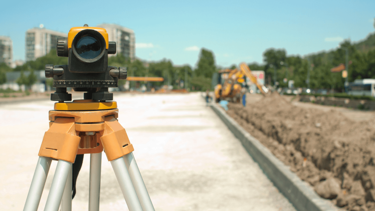
Simply put, a topographic survey is a precise and detailed map of land that shows all the natural and man-made features, such as hills, rivers, buildings, roads, and others. Engineers and developers use this information to make smart decisions for their utility locating service projects. It’s like having a GPS for your project that shows you the full picture to avoid surprises down the road.

Why Do You Need a Topographic Survey?

Utility Locating:

Have you ever wondered how they find all those underground cables and pipes? That’s utility locating. With the help of advanced methods like Ground Penetrating Radar and Electromagnetic Locators, surveyors can pinpoint exactly where these underground utilities are. It is one of the important steps to ensure new projects don’t interfere with existing ones. It keeps everything safe and adheres to local codes.

Legal Boundaries:

Apart from technical factors, a topographic survey has a social and legal aspect. It helps sort out property boundaries and avoid disputes between owners. Respecting each other’s space and personal property is crucial in the context of property development and urban planning, and it ensures satisfaction by completely adhering to local laws and regulations.

Construction and Development:

Before the construction of any building, a topographic survey is a must. It allows architects and engineers to design safely and according to local regulations based on the information provided. Particularly in places like California, where earthquakes and seismic activities are common, these surveys allow engineers to ensure their buildings can withstand natural disasters.

Environmental Conservation:

Topographic surveys are not limited to commercial sites and projects. Rather, they also offer scope beyond buildings and roads. These surveys are vital for protecting the environment. Utility locators help conservationists manage resources and preserve biodiversity by mapping out natural landscapes and habitats. For an eco-conscious state like California, balancing development with environmental care is crucial.

What devices and tools are used for a topographic survey?

Topographic surveys might sound technical, but they’re important and necessary for all kinds of projects. Whether building something new, dealing with property lines, or just trying to keep everything safe and up to code, these surveys give the detailed information an authority may need to get it right. Plus, they’re key to protecting the environment, especially in a place like California.

  • GPS and GIS:

Global Positioning System (GPS) and Geographic Information System (GIS) have revolutionized land surveying and underground utility locating techniques. They offer real-time data and detailed visual maps, which makes it easier for the authorities to plan and develop projects with accuracy.

  • Drones:

Drones are a game-changer in surveying, particularly for utility locating in California, as they have made it easy to reach places like mountains and forests. Their ability to capture high-resolution aerial views and images, the less time required to cover a particular area, and, of course, fuel and cost savings have allowed for detailed topographic maps in no time.

  • 3D Laser Scanning:

It’s like making a microcopy of a particular piece of land or place. 3D Laser Scanning captures precise 3D data to create accurate models of the land. In urban areas, it is often used to plan new infrastructure, which ensures that every new development or entity is according to environmental laws.

Benefits of a Topographical Survey

It is obvious that correct measurement and accurate data are the backbone of any project. Without them, designers and engineers are left guessing, leading to unavoidable, costly mistakes and delays. Topographic surveys provide the detailed information needed to make informed decisions, minimize risks, and keep projects on track.

  • Planning Development:

Whether you’re building a house or a whole neighborhood, accurate measurements are crucial for targeted planning, design, and efficient resource utilization.

  • Land Area Measurement:

For legal documents, getting the land area right is a basic necessity. Precise measurements ensure everything holds up legally.

  • Irrigation Channels: Proper water management is essential, especially for new developments. Topographic surveys help design effective irrigation channels to prevent flooding.
  • Residential Development: In crowded urban areas, these surveys help determine if a site is suitable for new housing, ensuring it meets the needs of the community.
  • Project Accuracy: For large projects, accuracy is everything. Topographic surveys help keep things on track, ensuring the project meets its long-term goals.
  • Tourism and Sightseeing: Planning tourist attractions? A precise survey ensures that everything, from the views to the infrastructure, is top-notch.
  • Road Construction: Building roads, especially in remote areas, requires precise measurements to make sure they’re safe and functional.
  • Regional Boundaries: Determining regional boundaries requires expert surveys. These results are legally binding and essential for municipal planning.
  • Map Creation: Finally, topographic surveys are key to creating accurate maps, whether for education, legal use, or planning purposes.

Topographic surveys are essential for everything, from small property disputes to large-scale development projects. By using expert services, you can ensure your project is built on a solid foundation of accurate, reliable data.

Why Topographic Surveys Matter in California

In California, where the landscape is as varied as the people, topographic surveys are a must. Whether you’re dealing with earthquake zones, designing new buildings, or planning a road through the mountains, these surveys help you get it right the first time. They’re also key to keeping the state’s natural beauty intact while still allowing for growth.

So, whether you’re starting a new project or just want to understand your land better, a topographic survey is the way to go. Accurate utility mapping and safe excavation are guaranteed by our cutting-edge ground-penetrating radar technology. To learn more, contact our team at Util-Locate today!

How to Detect Environmental Hazards With GPR

utility locating services

Key Takeaways:

  • Ground-penetrating radar (GPR) is a non-invasive tool for identifying and assessing environmental hazards like underground storage tanks, contaminated soil, and buried waste.
  • Applications of GPR in environmental projects locate underground storage tanks, detect contaminated soil, and help find buried waste.
  • Proper planning ensures a successful survey. During the survey, use a grid pattern, adjust settings, and monitor data quality. Analyze the data carefully for accurate hazard identification.
  • GPR is non-invasive, offers high-resolution images, is versatile for various environments, and is cost-effective compared to invasive methods.
  • Effectiveness is limited by depth and soil conditions. Data interpretation requires expertise and environmental regulations must be followed.

Environmental hazards pose significant risks to both the environment and human health. Effective detection and management of these hazards are crucial for maintaining safe and sustainable environments.

One of the most powerful tools in this field is ground-penetrating radar (GPR). In combination with utility locating services, GPR provides a comprehensive method for identifying and assessing environmental hazards.

This blog will explore how GPR works, its applications in detecting environmental hazards, and best practices for utilizing this technology.

Let’s Define Ground-Penetrating Radar

Ground-penetrating radar is a non-invasive geophysical method that uses radar pulses to image the subsurface.

It is widely used in various industries, including environmental science, construction, and archaeology. GPR is particularly valuable for detecting underground anomalies without the need for excavation.

How GPR Works

GPR operates by emitting radar waves into the ground. When these waves encounter different materials or objects, they reflect back to the surface and are detected by the GPR system.

The reflected signals are then processed to create a visual representation of the subsurface.

Applications of GPR in Detecting Environmental Hazards

Ground-penetrating radar is highly effective in identifying various types of environmental hazards. Below are some of the key applications of GPR in this field:

Detect Underground Storage Tanks (USTs)

Underground storage tanks (USTs) can pose significant environmental risks if they leak hazardous substances. GPR can locate these tanks and assess their condition.

  • Leak Detection: Identifies potential leaks in storage tanks.
  • Mapping Locations: Creates detailed maps of UST locations.
  • Assessing Integrity: Evaluates the structural integrity of USTs.

Locate Contaminated Soil

Contaminated soil is a major environmental hazard that can affect ecosystems and human health. GPR is effective in identifying areas of soil contamination.

  • Identifying Hotspots: Pinpoints areas with high levels of contamination.
  • Determining Extent: Assesses the extent and depth of contamination.
  • Monitoring Remediation: Tracks the progress of soil remediation efforts.

Detect Buried Waste

Illegal dumping and buried waste can lead to severe environmental damage. GPR helps in locating and assessing buried waste sites.

  • Identifying Dump Sites: Locates illegal dump sites.
  • Characterizing Waste: Determines the type and volume of buried waste.
  • Assessing Impact: Evaluates the environmental impact of buried waste.

Best Practices for Using GPR in Environmental Hazard Detection

To maximize the effectiveness of ground-penetrating radar in detecting environmental hazards, it is essential to follow best practices. Here are some guidelines to ensure accurate and reliable results:

Pre-Survey Planning

Before conducting a GPR survey, thorough planning is crucial.

  • Define Objectives: Clearly outline the goals of the survey.
  • Site Assessment: Conduct a preliminary assessment of the survey site.
  • Equipment Selection: Choose the appropriate GPR equipment for the task.

Conduct the Survey

During the survey, adherence to best practices ensures high-quality data collection.

  • Grid Pattern: Use a systematic grid pattern to cover the survey area comprehensively.
  • Adjust Settings: Fine-tune GPR settings based on soil conditions and target depth.
  • Monitor Data: Continuously monitor data quality during the survey.

Data Analysis and Interpretation

Accurate analysis and interpretation of GPR data are crucial for identifying environmental hazards.

  • Data Cleaning: Remove noise and irrelevant data points.
  • 3D Visualization: Create 3D models of the subsurface for better interpretation.
  • Expert Review: Have data reviewed by experienced GPR analysts.

Advantages of Using GPR for Environmental Hazard Detection

Ground-penetrating radar offers several advantages over traditional methods of environmental hazard detection:

  • Non-InvasiveGPR is a non-invasive technique, meaning it does not disturb the environment during surveys. This is especially important for sensitive or protected areas.
  • High Resolution – GPR provides high-resolution images of the subsurface, allowing for detailed and accurate identification of hazards.
  • Versatility – GPR can be used in various environments and conditions, making it a versatile tool for environmental hazard detection.
  • Cost-Effective – Compared to invasive methods, GPR is a cost-effective solution for identifying and assessing environmental hazards.

Challenges and Limitations

While ground-penetrating radar is a powerful tool, it does have some limitations:

Depth Penetration

The effectiveness of GPR decreases with depth. Penetration depth depends on the frequency of the radar waves and the conductivity of the ground material.

Soil Conditions

Soil conditions, such as moisture content and soil type, can affect the accuracy of GPR data. High moisture levels can reduce the effectiveness of GPR.

Data Interpretation

Interpreting GPR data requires expertise and experience. Misinterpretation of data can lead to incorrect conclusions about the presence or absence of hazards.

Environmental Regulations and Compliance

Adhering to environmental regulations is critical when using ground-penetrating radar for hazard detection.

Regulatory compliance ensures that surveys are conducted ethically and legally, protecting both the environment and the surveyors.

Key Regulatory Bodies

  • Environmental Protection Agency (EPA): Oversees environmental protection standards and regulations.
  • Occupational Safety and Health Administration (OSHA): Regulates safety practices during environmental surveys.
  • State and Local Agencies: Various state and local environmental agencies have their own regulations and guidelines.

Compliance Best Practices

  • Understand Regulations: Stay informed about relevant regulations and guidelines.
  • Document Procedures: Maintain detailed records of survey procedures and findings.
  • Follow Safety Protocols: Ensure all safety measures are in place to protect surveyors and the environment.

Future Trends in GPR for Environmental Hazard Detection

The future of ground-penetrating radar in environmental hazard detection looks promising, with ongoing research and development aimed at further enhancing its capabilities. Some emerging trends include:

Autonomous GPR Systems

Development of autonomous GPR systems that can operate without human intervention, increasing efficiency and safety.

  • Drones and Robots: Autonomous vehicles equipped with GPR can survey hazardous or inaccessible areas.
  • Increased Efficiency: Reduces the need for manual labor and speeds up the survey process.

Machine Learning and AI

Integration of machine learning and artificial intelligence (AI) to improve data analysis and interpretation.

  • Enhanced Data Accuracy: AI algorithms can identify patterns and anomalies more accurately.
  • Predictive Analysis: Machine learning models can predict potential hazard zones based on historical data.

Environmental Monitoring Networks

Creating networks of GPR sensors for continuous environmental monitoring.

  • Real-Time Monitoring: Provides ongoing data about environmental conditions and potential hazards.
  • Early Warning Systems: Alerts stakeholders to emerging hazards before they become critical.

Stay Ahead with Cutting-Edge GPR Technology

Ensure the safety and sustainability of your projects with the latest in ground-penetrating radar technology. At Util-Locate, we offer comprehensive utility locating services that leverage advanced GPR capabilities to detect and manage environmental hazards.

Contact us today to learn how our expertise can benefit your environmental projects and keep you compliant with all regulations. Protect your site, your workers, and the environment with Util-Locate’s professional services.