Why Your Commercial Complex Needs a CCTV Drain Survey Now

Why Your Commercial Complex Needs a CCTV Drain Survey Now

CCTV is a brilliant way to survey the condition of your pipes and entire drainage system. With the use of camera systems, it can help find many types of plumbing problems like a blockage from debris buildup or worrying drain damage.

For anyone managing or running a business unit or building, an annual or regular drainage report can help you understand what state your pipes are in and if any damage has occurred. The drain survey service provided by Util-Locate is prompt and affordable and will help you keep your building in great shape.

Keep reading to find out more about CCTV drain surveys and how they can benefit your property and its drainage system.

What is a CCTV Drain Survey?

A CCTV drain survey is a very thorough drain inspection that uses state-of-the-art camera technology to show what is happening throughout your commercial property’s pipes and drains. These CCTV cameras are led through the pipe system to get a proper handle of any drainage issue even in the narrowest areas.

This type of drain survey is more in-depth than other methods and provides an efficient way for plumbing professionals to understand what problem might be occurring in your drain system. A CCTV survey is also very cost effective so that you can stay within your normal maintenance and repairs budget.

The CCTV camera is hooked up to a monitor or phone and sends a live feed of the pipes as it goes through the drainage system. Contractors and the plumbing team on the site will be able to advise you on what was discovered during the inspection and a repair plan if any issues or damage is discovered.

Why Would I Need a CCTV Drain Survey?

Drain surveys are especially useful for commercial complexes where there are often much larger drainage systems and regular drain surveys are required for proper upkeep. What’s more, such surveys will allow plumbers and contractors to locate and report any problem quickly, which means the right solution will be implemented as soon as possible.

Whether you are a building manager or owner, you likely know how common drainage issues can be. By scheduling a CCTV drain survey, you will be taking an important preventative step to ensure that no drainage issue causes long-term damage.

When are CCTV Drain Surveys Needed?

For commercial properties, it is advisable that CCTV surveys should be regularly scheduled. Typically, this means either annually or twice a year, depending on the volume of usage on the pipes and drains.

That said, your drainage issue might be severe and require immediate response. If you are experiencing any of these sewer and drainage issues, be sure to seek help immediately:

Regular Blockages

This is one of the most common reasons why a drainage survey is required. It will help your contractor if they know the exact location of the blockage in the pipe before they can clear it and return your pipes to working order. Leaving a blockage in your drainage system can result in more blockages developing and damage to the sewers.

Subsidence

Some locations are more prone to subsidence and ground movement. If you are concerned that your commercial complex may be experiencing signs of subsidence, it is very important to have a a CCTV drain survey carried out for a full evaluation of your property’s drains. Subsidence can cause major problems down the line and it is very important to ensure the drain’s condition is solid.

Leaks

If the building experiences regular leaks or clean or waste water, it is definitely a time to call us for a CCTV survey. There could be a tree root infestation in your drains or poorly connected pipes that need to be repaired or replaced. Leaving your pipes in this condition can result in damage that affects the building’s entire drain system.

A CCTV survey for your drainage system is the quickest and most affordable way to diagnose the problem.

Whether it is build-up or a problem with the building structure, our professional team works with top-of-the-range cameras and technology will be able to find the solution to your problem.

Book an Expert Team

When it comes to CCTV drain surveys, they should only be handled with experts who have access to the best tools and equipment. At Util-Locate, we take solving all of our customers’ drain problems very seriously.

We also have the expertise and experience required to ensure your drains and pipes are left in the best state and condition following a drainage survey and any of our services.

Our team has all the required training to use top quality equipment and cameras, which allow us to make the most accurate drainage surveys and project reports. If you are experiencing a drain problem, our experts will be able to solve it with brilliant customer service.

Alongside our utility locating services, we can perform CCTV surveys to discover all the details of your drains. For a menu and description of every service we offer, take a look at our website. You can also request a quote for one of our services, including surveys.

For more information about the services we provide and how CCTV drain surveys can benefit all aspects of your commercial complex and unit plumbing system, don’t hesitate to contact us.

We also offer a 24/7 emergency drain service if you experience an emergency on your property. Simply call us at the Util-Locate emergency number at 1 (866) 638-1075.

What Exactly is GPR and Why Do I Need It?

What Exactly is GPR and Why Do I Need It?

Digging up the ground is so much work and takes so much time. Locating where utilities and structures are underground before digging would make the excavation so much easier.

This is why utility locators, construction companies, and archeologists use Ground Penetrating Radar technology.

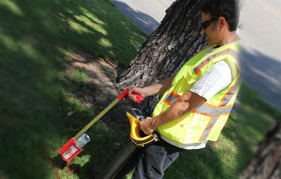
Ground penetrating radar technology, commonly known as GPR, is a method of capturing images underneath the ground through the use of electromagnetic energy. As such, GPR technology makes subsurface mapping and locating objects so much easier.

These services have many advantages, from reducing time and effort in locating any object underground to minimizing possible accidents from damaged utility lines.

How Does GPR Work?

A ground penetrating radar uses a transmitter to send signals in the form of radio waves in the 1 to 1000 MHz frequency range into the soil, concrete, or another material.

When these signals hit any object in the soil or concrete, they bounce back, reflecting, refracting, and scattering. It uses an antenna to receive and record these reflected signals, and from there the device calculates the depth and position of an object under the ground.

Aside from measuring depth and location, a ground penetrating radar GPR can also detect material property, size, and shape. This makes generating 2D or even 3D images of objects possible.

Advantages of Ground Penetrating Radar Technologies

As mentioned earlier on in the article, such imaging technologies can detect a wide range of materials buried beneath the surface without damaging the surface.

Compared to calling 811 or using old utility maps, this type of radar can help determine where utility lines are right when you need to know it. It therefore helps eliminate the need for additional allowances in distance due to human error or movement in utility positions due to temperature changes.

Unlike other methods of subsurface mapping, GPR can characterize subsurface properties and identify what kinds of compounds are underground in any given infrastructure. It does so by gathering a wide set of data which makes subsurface geo-referencing possible.

What’s more, GPR’s real-time data features means it’s useful for detecting forgotten or undiscovered items, underground facilities, and other types of surveys.

Utility Mapping Applications

This imaging method can find variances in the return signals caused by different electric charges depending on the substance detected. These services are especially useful for mapping structures since excavators can accurately plan around whatever is underneath the ground.

Such data is then used by excavators to avoid digging accidents, or even by archaeologists to dig up promising artifacts.

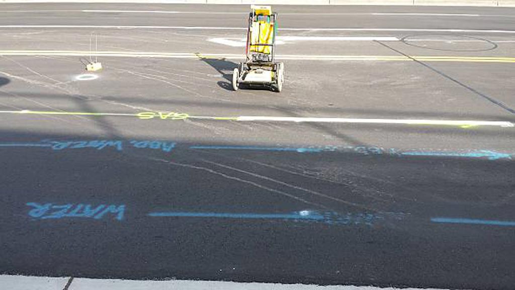
GPR, detects metal and nonmetal materials such as plastic, concrete, wood, stone, etc. This makes it useful for detecting electric wires and cables, gas and water pipes, as well as tree roots, stone slabs, and man-made underground fixtures or architecture.

How to Make GPR Data as Accurate as Possible

While there are tons of advantages to using a ground penetrating radar, such services work best under certain environmental factors. To get the most accurate, real-time data from ground penetrating radar services, make sure that these factors are in place.

Soil Properties

One of the conditions needed for GPR to work well is for the surface to be relatively flat; this is necessary to ensure optimum penetration of electromagnetic energy which also results in the most accurate subsurface detection. This means GPR works really well on concrete as opposed to uneven terrain.

Because GPR relies on materials reflecting or refracting signal, anything different from the scanned material can obstruct the reading of the device and limit its extensive scanning capacity.

Depth

Another factor to consider when using GPR is the depth of the object or utility you’re trying to locate. Soil is naturally resistant to electricity; this makes scanning objects more and more difficult the deeper it goes into the ground. Depending on the capacity of the device, one may or may not penetrate as deep as 30 meters or 100 feet deep into the ground.

Water Content

The presence of water in the soil or any material found by GPR will also affect how well electromagnetic energy penetrates it because of dielectric permittivity. Dielectric permittivity refers to how conductive the soil or any surface is, which impacts how a GPR device receives the reflected or refracted signal it sends out.

What Is the Difference Between GPR and Seismic Reflection?

Though GPR and Seismic reflection both try to understand subsurface structures or characteristics, GPR uses electromagnetic energy in the form of radio waves whereas seismic reflection uses acoustic energy in the form of seismic waves.

GPR sends out high-frequency radio waves to detect changes in the electrical properties of a surface. Such changes exist when there’s an object made of a different substance than soil or concrete, as scanning can usually detect the varying electrical properties.

Meanwhile, seismic reflections rely on seismic waves hitting things or surfaces and reflecting back. A seismic device then records the surface’s elastic properties and density, both of which impact the signal reflected back.

Because they scan subsurface characteristics differently, GPR is best used for detecting things like artifacts and utilities whereas seismic reflection is best used to map flat surfaces.

Hiring a Professional Team

Ground penetrating radar equipment can cost anywhere from $15,000 to $50,000. This is a hefty investment for a homeowner in need of some utility mapping for a digging project. While you can rent a device for around $1,000 to $2,000 a day, that’s still impractical especially when you are not used to using it and interpreting the data it gives.

The accuracy of any GPR process relies heavily on who uses it. Using GPR incorrectly can lead to a false interpretation which undermines the purpose of utility mapping to begin with.

If your infrastructure project needs scanning and locating expertise, contact Util-Locate! Our team is made up of trained professionals who use GPR to expose all underground utilities for the most efficient utility locating and mapping services. For any questions about utility surveys or penetration projects, call us today!

12 Best Safety Practices During Utility Location

12 Best Safety Practices During Utility Location

Working outdoors is prone to many safety hazards. This holds especially true for projects like excavation work or utility locating. Digging up the ground where underground lines, cables, and pipes present many dangers, both natural and man-made.

As such, it’s absolutely important to observe the utmost precaution to ensure everyone’s safety and the success of any project. Effective planning involves thorough utility locating, utility infrastructure investigations, damage prevention as well as mitigation measures for issues identified during preliminary surveillance.

Plan Effectively

Every project is unique and will have its own schedule, budget, location, and scope. Depending on these factors, contractors will have to come up with a plan that will please the client while also ensuring the safety and wellbeing of the workers.

But utility locating happens outside where safety hazards abound and circumstances are unpredictable. Therefore, one must prepare contingencies for all possible scenarios that might take place.

Call Before You Dig

An easily avoidable common mistake is accidentally hitting or damaging a utility line. To do so, always call 811 before you dig. This holds true even for utilities projects that may seem simple and straightforward.

811 is the national call number for preventing the unintentional striking of underground utility lines. Pre excavation, call 811 to request help flagging the approximate locations of buried utilities in the area where you plan to excavate.

Create A Utility Map

While you should call 811 before excavation, it’s also good practice to devise a utility map before starting any utility service project. After all, there may be some private utility cables or unknown underground utility lines that 811 is not aware of or their information may be not updated.

To build a utility map, you can use old utility maps as a reference but never use them to guide your excavation. Utility maps need to be updated and creating one right before a new project is the best way to avoid accidents.

Homeowners near your excavation site usually know where their private utility lines are. One can also look for tanks and meters around a property to locate water pipes and electrical or gas lines.

Prevent Cave-Ins

One of the most common accidents experienced by utility locators when doing excavation work or working with underground utilities is collapsed tunnels or cave-ins.

To prevent this, utilities contractors must test the soil composition, as well as design and build structures that will function as support and provide shielding. Testing the soil ahead of time allows them to assess the likelihood of a cave-in whereas support beams can prevent tunnel collapse and shields can protect workers in the event of a cave-in.

Design Walkways and Barriers

No matter how careful excavators are, human error is still a huge risk. Though dropping an object or slipping and falling at home may not result in life-threatening consequences, doing so in a dig site can.

As such, any utility locator or excavator should first set up smooth and non-slippery walkways for workers to securely move about. They must also erect sturdy barriers around the area to prevent people from falling into pits.

Use the Proper Equipment

Excavation projects are no joke. Even with the most experienced utilities workers, most projects can’t be accomplished without the necessary tools.

If you’re a homeowner digging for a one-time project, investing in expensive equipment can be wasteful. Instead, hiring an experienced utility locator who already has such equipment and is experienced in using them to render services is going to be safer and more cost-effective.

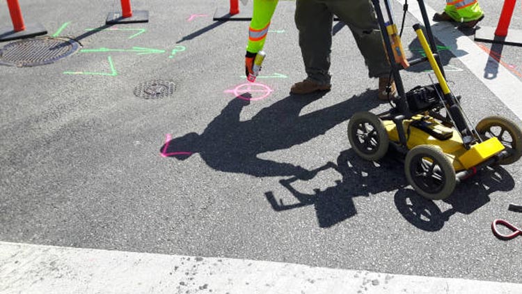
These excavators are trained to use equipment such as a ground penetrating radar to ensure survey markings are all recorded accurately.

Prepare Respirators

Dust and dirt are constantly in the air during excavations, which can in turn be hazardous to people’s health. Depending on the utility request, some teams even dig deep enough into the ground that oxygen levels begin to drop. Such lack of oxygen can cause lightheadedness, fatigue, and even fainting.

Before any light digging, workers must wear proper masks. If the project requires excavators to dig deep, workers need respirators or similar devices to help them breathe properly while working. This prevents them from collapsing or feeling sick; it will also help them avoid developing respiratory diseases due to work.

Bring Ear Plugs or Ear Muffs

During excavations, workers are surrounded by noisy equipment. Though this is part of the job, anyone exposed to high levels of noise for prolonged periods can risk ear damage and hearing loss.

Before starting any project, always conduct a noise assessment. If noise levels reach 85 dBA as an 8-hour TWA or more, workers must wear protective PPE like ear plugs or ear muffs.

Educate Workers

When digging, workers use heavy-duty dangerous equipment. Such devices need proper handling; otherwise, they can cause severe injuries while on the job. This is why educating workers is incredibly important. Moreover, workers must also be educated on how to properly use protective gear to ensure their safeties.

As a homeowner or excavation or construction company, it pays to train workers or work with contractors with proper training.

Supervise At All Times

An excavation project can’t just be done willy-nilly. There must be an experienced worksite supervisor who can govern the workers and make sure they all abide by safety protocols and follow the proper operational procedures.

Any compromises in this regard can easily lead to accidents and disaster so insisting on having someone capable at the helm of a project is a non-negotiable.

Put Signs, Reminders, and Warnings

Anyone is bound to forget a thing or two after they’ve been working for hours and days. This is why putting up a sufficient number of signs around the digging area can make a huge difference in disaster prevention.

Though it’s advised to stay at least 18 inches away from a marked underground utility, it’s highly encouraged to dig as far as you can because the mapping is not always accurate. For example, pipes can move due to changes in ground temperature over time.

To account for this reach, make sure to set up the appropriate reminders or warnings before you dig. Doing so in danger zones can boost alertness and vigilance minimizing the chances of accidents. This is also helpful for bystanders and utility owners who may want to help direct the flow of traffic around the utilities site.

Hire Professional Utility Locators

Whether you’re digging to install new underground utilities or doing some landscaping, you always want to observe the safety measures listed above to help protect yourself and everyone else around your worksite.

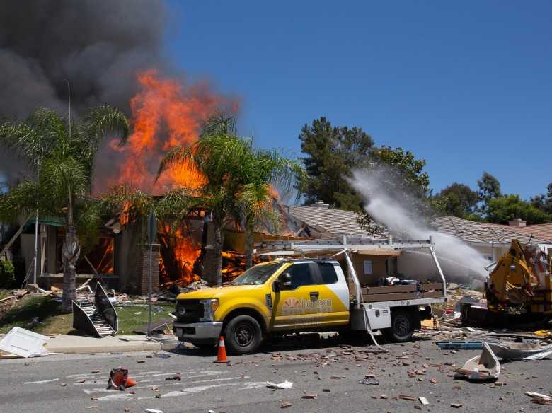
Accidentally hitting underground utilities can not only cause inconveniences such as water shortage or power interruption, it can also cause fire, serious injury, and possibly even death to the workers involved.

If you’re a property owner and have no experience with utility locating or digging in a utility site, you may not know what to do if you accidentally hit a gas line or a water pipe. Therefore, it’s highly advisable that you leave the job to utility companies or hire professionals who render utility locating services.

Our team is made up of professionals who have been in the utilities industry for years, and we meet all our requests with the utmost care. You can leave your private utility locating and mapping needs to us, so call Util-Locate, your trusted utility locator partner!

5 Reasons to Use a Ground Penetrating Radar (GPR) for Construction Projects

Utility locating services are a necessary step when preparing for any construction project, because they make construction safer and more efficient. Ground penetrating radar is a highly effective method that lets you know about any features below ground, from utility lines to septic tanks. It's always better to learn about your building site before getting a project started, to prevent any potential issues. With the help of ground penetrating radar, construction teams can prepare for underground obstacles and avoid costly mistakes. What Is GPR? Ground penetrating radar is a non-destructive method for getting images of anything beneath the ground, including voids. It uses radio waves to indicate the locations of objects below the surface. It has a wide variety of applications, including scientific studies, archaeology, and of course, construction. GPR technology functions by sending radar signals in the direction of a target area, which tells you if there's anything present there. A GRP system will interpret the reflected signals and assemble the data into an image of the object. When a survey is complete, you'll learn the exact locations of the utility lines and be made aware of any other subsurface features. How Does GPR Work? GPR works by using radio waves to locate objects underground. It transmits pulses of energy with a frequency range up to 1000 MHz. When those energy pulses are directed into the ground, objects below the surface reflect that energy and show up on the radar. All GPR systems are equipped with a receiver antenna, to record the reflected waves. Software assembles those reflected GPR signals into a visual, and the results show the size and shape of any object below ground. Each energy pulse returns more data to the receiver about the location and material properties of any items below. GPR equipment uses different frequencies to collect information about various depths and provide different resolution levels. With the help of GPR data, you can learn which areas contain utility lines or other potential obstacles. This method of data collection can detect all kinds of materials, including metal, rock, and PVC. Utility locating experts often start in areas marked for utility lines, but sometimes utility lines aren't where they should be. Other areas of interest include those with distinguishing features like valves. Once surveyors locate an object, they'll cover the area with the GPR cart or radar antenna more than once to get more details on the dimensions and depth of the item. GPR is a cost-effective way to survey an area before building on it, and it will keep you alert to any potential surprises, ranging from unauthorized utility lines to changes in soil composition. Advantages of a Ground Penetrating Radar GPRs provide plenty of advantages, and it's very useful as a non-destructive method of surveying an area before any excavation or building starts. A professional survey from a GPR device arms you with the information you need to make good decisions for your construction site. Here are some of the ways you can benefit from using a GPR on construction projects. 1. Provide a Starting Point The best time to get a GPR survey done is before you even start your project. If you ascertain the locations of underground utilities before you start to build, the process can go much more smoothly. Once you know where important utility lines are located, it's easier to build the rest of the structure around them. In some cases, utility lines may need to be moved before you can complete a construction project. 2. Keep Your Team Members Safe Underground utilities like pipes and wires are potentially dangerous. Cut power lines can electrocute people, and gas lines can cause explosions. The GPR results for your construction site will let you know the exact location of utility lines so you can avoid any unfortunate surprises. You can prioritize safety for your team members by getting professional utility locating services. 3. Avoid Costly Damage Not only are utility lines dangerous, they can also cause significant damage to your site or building materials. Explosions, fires, and floods from cut utility lines can result in a lot of damage to building materials and equipment. Damage prevention is always cheaper than repairs or replacements, so invest in a GPR survey before construction begins. 4. Get More Accurate Results Utility mark outs are made with the best of intentions, but they aren't always accurate. Sometimes they're made using old, out of date records. Instead of relying on provided records, play it safe and get professional utility locating. GPR lets you find the location of any utilities easily and with a 97% accuracy rate up to a depth of 13 feet. This survey method tells you the specific locations of important utility lines. It can even detect a wide range of materials, not just conductive metals. Professional utility locators can also adjust the antenna frequency to detect items at different depths. High frequency radio waves provide higher resolution, giving you the most accurate reading of subterranean obstacles. 5. Discover Potential Obstacles During utility location, people normally have an idea of what to expect and what to look for, like gas and power lines. However, some obstacles might not show up on records, either because they're naturally occurring or they were done unofficially. Without GPR survey, concrete structures and abandoned lines could take you by surprise. Items like tree roots or buried objects can get in the way of your building project, but a GPR technician will alert you to these obstacles before they become a serious problem. GPR systems even let you know about the soil conditions of the building site! How Effective Is GPR? GPR is a useful tool in an arsenal dedicated to figuring out subterranean conditions and obstacles. It's an important part of any construction site preparation. This survey method has an incredible 97% accuracy rate with a penetration depth of 13 feet. What's more, GPR procedures are low-cost, work quickly, and are great for locating important structures below ground without disturbing the soil. It's the best technology available for surveying a site, and it can save you a lot of money by preventing expensive problems. Before you start a project that involves digging into the ground, get professional utility locating services first. Util-Locate uses cutting-edge technology to provide fast and accurate readings for utility line locations. Contact us today to learn more about our services or to schedule an appointment.

Utility locating services is a necessary step when preparing for any construction project because they make construction safer and more efficient. Ground penetrating radar is a highly effective method that lets you know about any features below ground, from utility lines to septic tanks.

It’s always better to learn about your building site before getting a project started, to prevent any potential issues. With the help of ground-penetrating radar, construction teams can prepare for underground obstacles and avoid costly mistakes.

What Is GPR?

Ground penetrating radar is a non-destructive method for getting images of anything beneath the ground, including voids. It uses radio waves to indicate the locations of objects below the surface. It has a wide variety of applications, including scientific studies, archaeology, and of course, construction.

GPR technology functions by sending radar signals in the direction of a target area, which tells you if there’s anything present there. A GRP system will interpret the reflected signals and assemble the data into an image of the object.

When a survey is complete, you’ll learn the exact locations of the utility lines and be made aware of any other subsurface features.

How Does GPR Work?

GPR works by using radio waves to locate objects underground. It transmits pulses of energy with a frequency range up to 1000 MHz. When those energy pulses are directed into the ground, objects below the surface reflect that energy and show up on the radar. All GPR systems are equipped with a receiver antenna, to record the reflected waves.

Software assembles those reflected GPR signals into a visual, and the results show the size and shape of any object below ground. Each energy pulse returns more data to the receiver about the location and material properties of any items below. GPR equipment uses different frequencies to collect information about various depths and provide different resolution levels.

With the help of GPR data, you can learn which areas contain utility lines or other potential obstacles. This method of data collection can detect all kinds of materials, including metal, rock, and PVC.

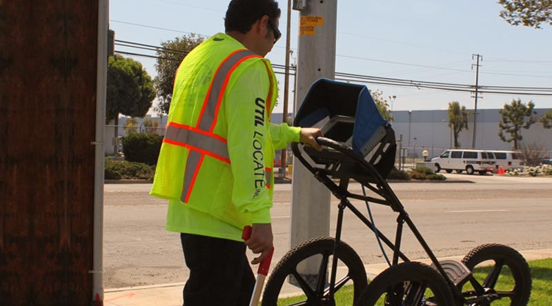
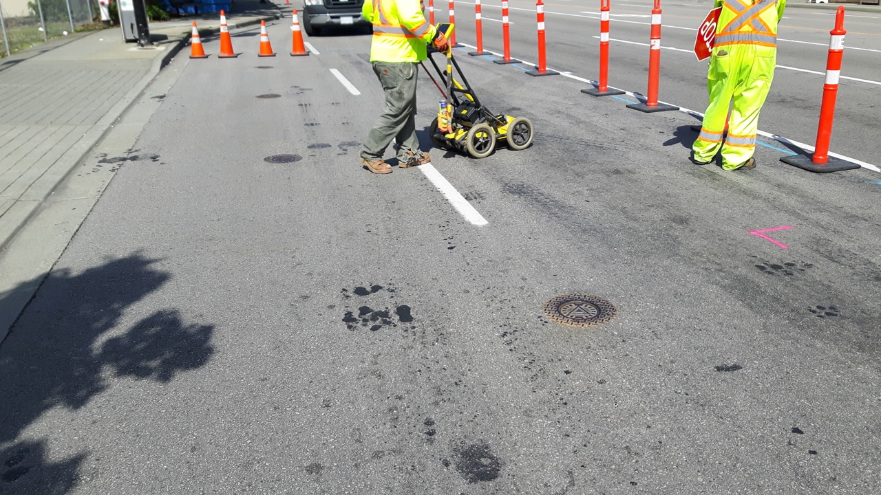
Utility locating experts often start in areas marked for utility lines, but sometimes utility lines aren’t where they should be. Other areas of interest include those with distinguishing features like valves. Once surveyors locate an object, they’ll cover the area with the GPR cart or radar antenna more than once to get more details on the dimensions and depth of the item.

GPR is a cost-effective way to survey an area before building on it, and it will keep you alert to any potential surprises, ranging from unauthorized utility lines to changes in soil composition.

Advantages of a Ground Penetrating Radar

GPRs provides plenty of advantages, and it’s very useful as a non-destructive method of surveying an area before any excavation or building starts. A professional survey from a GPR device arms you with the information you need to make good decisions for your construction site.

Here are some of the ways you can benefit from using a GPR on construction projects.

1. Provide a Starting Point

The best time to get a GPR survey done is before you even start your project. If you ascertain the locations of underground utilities before you start to build, the process can go much more smoothly.

Once you know where important utility lines are located, it’s easier to build the rest of the structure around them. In some cases, utility lines may need to be moved before you can complete a construction project.

2. Keep Your Team Members Safe

Underground utilities like pipes and wires are potentially dangerous. Cut power lines can electrocute people, and gas lines can cause explosions. The GPR results for your construction site will let you know the exact location of utility lines so you can avoid any unfortunate surprises.

You can prioritize safety for your team members by getting professional utility locating services.

3. Avoid Costly Damage

Not only are utility lines dangerous, they can also cause significant damage to your site or building materials. Explosions, fires, and floods from cut utility lines can result in a lot of damage to building materials and equipment.

Damage prevention is always cheaper than repairs or replacements, so invest in a GPR survey before construction begins.

4. Get More Accurate Results

Utility mark outs are made with the best of intentions, but they aren’t always accurate. Sometimes they’re made using old, out-of-date records. Instead of relying on provided records, play it safe and get professional utility locating.

GPR lets you find the location of any utilities easily and with a 97% accuracy rate up to a depth of 13 feet. This survey method tells you the specific locations of important utility lines. It can even detect a wide range of materials, not just conductive metals.

Professional utility locators can also adjust the antenna frequency to detect items at different depths. High-frequency radio waves provide higher resolution, giving you the most accurate reading of subterranean obstacles.

5. Discover Potential Obstacles

During utility location, people normally have an idea of what to expect and what to look for, like gas and power lines. However, some obstacles might not show up on records, either because they’re naturally occurring or they were done unofficially. Without a GPR survey, concrete structures and abandoned lines could take you by surprise.

Items like tree roots or buried objects can get in the way of your building project, but a GPR technician will alert you to these obstacles before they become a serious problem. GPR systems even let you know about the soil conditions of the building site!

How Effective Is GPR?

GPR is a useful tool in an arsenal dedicated to figuring out subterranean conditions and obstacles. It’s an important part of any construction site preparation. This survey method has an incredible 97% accuracy rate with a penetration depth of 13 feet.

What’s more, GPR procedures are low-cost, work quickly, and are great for locating important structures below ground without disturbing the soil. It’s the best technology available for surveying a site, and it can save you a lot of money by preventing expensive problems.

Before you start a project that involves digging into the ground, get professional utility locating services first. Util-Locate uses cutting-edge technology to provide fast and accurate readings for utility line locations.

Contact us today to learn more about our services or to schedule an appointment.

9 Misconceptions About Underground Utility Locating

Trusted Utility Locating Services

Underground utilities, also known as subsurface utilities, are infrastructures found underground to provide services to people. They are most commonly built by public utility companies but are also installed as private utilities by property owners. Such public utilities come in the form of pipes and cables that transport lots of things, from water to your internet connection.

Depending on the location, utility locating could also be done on a private utility. Things such as self-installed home filtration systems, sewer lines, garden sprinkler systems, are all examples of such infrastructure.

What Are Utility Location Services For?

Because these infrastructures are below the ground, anyone who plans to excavate either for public or private purposes will need to plot where these utilities are before they do any digging. Utility location refers to the entire process of plotting such infrastructure, from identifying where utility lines are to labeling each line properly.

Explaining What 10 Myths on Underground Locating Really Mean

1. All utility mark outs are accurate.

Utility mark outs are often inaccurate. Whenever you’re doing some excavation work, always proceed with caution.

You never know whether mark outs are inaccurate or incomplete. Don’t trust mark outs, since they may be based solely on records. Even ones done using the most advanced locating technologies are not very reliable because all locating technologies have limitations and instrument readings can change depending on the operators’ interpretations.

The best way to approach mark outs is to stir as far away from them as possible. Ideally, set your drilling location five to 10 feet away from marked lines. After all, a marked line could be one pipe or cable or it can be a group of pipes and cables together.

2. I can dig in a spot without the need to hire utility locators.

A lack of utility marks could mean the area has never been located before, not that there are no utilities present. Never dig on lots without going through proper procedures. Rarely are there no utilities where there are no marks; more often than not, you’d find unlocated utilities in such areas. You should ask around about utilities and facilities in the area.

You can also inspect the area yourself for signs of underground activities such as repaired pavement, disturbed soil, utility boxes, or wires, cables, and pipes coming from the ground. Better yet, hire Trusted Utility Locating Services to do the work for you. 

3. Depths of utilities can be assumed or estimated.

You cannot assume or estimate the location or depth of utilities without exposing them first. Lines can shift or settle, changing their depths over time; and any mark usually only indicates horizontal locations. So never make assumptions.

4. Utility strikes will not happen to me.

The biggest myth is the idea that you’re exempt from utility strikes. Just because something has never happened to you before does not mean it cannot happen. In fact, in 2019 there was an estimated 532,000 excavation-related damages to underground facilities across the country.

5. I only have to do utility mapping once.

Underground utility locating should be conducted every time before you dig up a piece of land. The depth of pipelines, cables, and so on changes over time and new utilities are always being added to the mix. So never skip utility locating prior to any project.

6. I can use an old map.

Mapping underground utilities is a long and continuous process, so you can’t always rely on old maps to guide you. If it’s been more than 5 years, the map is no longer up to date. Always get a location survey before you start any and all utility services projects. 

7. A ground-penetrating radar (GPR) can see all underground utilities.

A GPR can detect some utilities via geophysical radar pulses, but they only work as extensions of human senses.

Simply put, any GPR is limited by penetration depth and data interpretation when detecting such infrastructure. So though they are helpful, do not rely on them too heavily and always remain on the safe side when excavating.

8. I don’t need to worry about abandoned lines. 

Never make assumptions in these situations. Seemingly abandoned lines are possible conduits for new utilities, and they can be plugged at one end but be connected on the other. Abandoned lines can still pose a danger to you and everyone else so exercise utmost caution. 

9. 811 is liable for accidents.

Just because you called 811 does not mean you have done all you should when it comes to underground utility locating. The team on the other line can help coordinate with locating service providers to have a utility map of the area, but that’s as much as they can do.

It is important to remember that you are still responsible as an excavator to verify the marks provided to you. After all, when there’s a utility strike, it will be your cost to bear. There’s no harm in double-checking just to be extra sure.

Best Practices to Avoid Accidents

It pays to be extra cautious when it comes to excavations. Do everything you can to minimize the risks that come with digging.

Call 811

811 is the federally assigned hotline to call before you do any digging.

Call the hotline at least a few days before you do any digging to help make sure you’re educating yourself on the underground utilities present in your excavation area before you begin any project. This can go a long way in preventing any breaches or accidents when it comes to disturbing an existing underground utility line.

Hire Professional Utility Locating Services

When in doubt, it always pays to hire a professional. They have the necessary equipment and the best technology to carry out the safest excavations with the least surface disruption via hydro excavation.

Contact a reliable utility locating service to make sure you know where underground utilities are and how deep they are in the ground.

We at Util-Locate pride ourselves on being South California’s leading private utility locating company. Our team is one call away, so contact us today to make sure your utility location project goes smoothly!

Utility Potholing for Small Projects: Better Safe Than Sorry

why utility potholing is essential

Thanks to modern excavating tools and methods, i.e., air and hydro vacuuming excavation, utility potholing became the new and safer strategy prior to the start of home and other construction projects.

Digging used to be the standard when checking underground utility lines and performing directional drilling work, but it had many disadvantages. It is prone to damages—of the actual lines, other pipes, bedding, and anything else that a shovel or backhoe will hit.

Keep reading below to find out more about what utility potholing is and why it’s a safer option for small projects.

The Importance of Utility Potholing in Home and Building Projects

What Does Potholing Mean?

Potholing uses vacuum excavators, which are portable pressurized units that use water or air to help locate subsurface lines and obstructions in and around a bore path. It was originally used to clean septic tanks and car wash pits and remove slurry from drilling projects.

Throughout the years, contraction services have used it as a non-destructive and visual confirmation technique in checking and exposing underground utility lines prior to proceeding with building projects.

What Is Utility Potholing?

Utility potholing is a method used to gather ocular information on an infrastructure project’s underground using vacuum excavators with pressurized air or water. It involves digging a 6-12 inches deep hole to determine:

  • The presence and position of buried utility lines (underground utility locating)
  • The type/s of underground utilities
  • Correct drilling and sewer depth
  • Signs of damage to existing utilities (electrical or water)

What Are the Benefits of Utility Potholing?

Excavation potholing, as the practice is sometimes  called, is a time-saving and economical practice that aids in locating significant underground beds or sewer in directional drilling, horizontal directional drilling, and utility engineering. It also prevents blind digging and, later on:

  • Damage to underground utility lines
  • Life-threatening accidents
  • Electrical service interruptions and outages
  • Building project delays
  • Equipment damages
  • Spending on unnecessary repair services
  • Contractor fines and liability issues

Utility potholing ensures overall construction site safety. Rather than relying solely on utility locating maps and charts, which can be outdated, contractors are able to get to see first hand the situation underneath with the use of this self contained practice.

How Does Utility Potholing Work?

Both air and water can be used in utility potholing. They are pressurized to move ground contents quickly for a better view of buried utilities.

So, do you use air or water?

The answer depends on the nature of the construction project you’re dealing with. But, hydro vacuum excavation is more frequently recommended because air excavation doesn’t get rid of spoil, which ends up demanding more time and money to clean up at the end of the day.

How Does Hydro Excavation Work?

To give you an overview of the utility locating process, here is a general step-by-step process of hydrovac excavation:

  1. A piece of hydro excavation equipment or truck is used to put high pressure on its water content to break through the soil, cement, clay, grass, or compound surface and expose existing utilities underneath. Note: Safety practices encourage a test hydro excavation run first using a low pressure on a shallow depth. This is an add-on safety measure to prevent damage to underground utilities.
  2. Then, the slurry or hydrovac waste containing the broken-down soil is lifted up using a vacuum and transferred to and stored in a holding tank. Now, there are two types of vacuum that can be used for hydro excavation. One is a fan blower and the other is a positive displacement blower. The former is more commonly used in construction and line installation services because it is cheaper and can vacuum up soil in large amounts.
  3. The entire process is a utility locator that, once done, gives a good view of the buried pipes and tubes. What follows depends on the nature of the project, e.g., new line installation, pipe repair, pole setting, etc. Whether the removed slurry is returned and spread back on the dig site, incorporated as fill material, or disposed of at a liquid waste facility depends on local government guidelines and the contractor you’re working with.

What Are the Benefits of Hydro Excavation?

The hydro vacuum excavation process ultimately minimizes damages and potential disruptions to existing infrastructure and utilities.

Its other benefits include:

  • Providing a safer and less manual method for utility workers during excavations and construction
  • Minimizing the need for additional equipment, e.g., more shovels, backhoes, or water to remove soil or cement
  • Preventing damage to existing establishments and electrical lines through a controlled way of excavating
  • Limiting congestion in the construction work area as the truck can be situated at a distance and perform its function via a hose line

Are There Other Applications of Hydro Vacuum Excavation in Construction?

Apart from potholing, the hydrovac process can also be used when:

  • Removing debris from drainages and manholes
  • Excavating narrow streets, narrow trenches, planting strips, and limited-space yards
  • The weather is freezing
  • Pole drilling and setting
  • Locating community or household sewer
  • Installing a new line (electricity, water, telecommunication, etc) to a residential or business area

Contact Us for Utility Locating Services in Southern California

Utility potholing comes with advantages that go beyond giving a look into a project’s underground utilities situation. It’s a method that helps ensure workplace safety, a smooth flow of repair services, prevents ground damage, and allows for proper installation of line poles.

Opting to do it prior to the start of a construction or line project, big or small, won’t ever go wrong and will leave you with no regrets later on.

If you have a building or line project on hand and are looking for reliable services, Util-Locate specializes in mapping, CCTV, ground-penetrating radar, and underground utility locating services. Our company has been around since 2001 providing cost-effective solutions on residential and commercial utilities to both professional clients and homeowners.

Contact us today at 1 (866) 638-1075 or leave us a message to place your inquiries about our services or schedule line installation work with our crew at Util-Locate.